|
 |
 |
 |
 |
 |
 |
 |
 |
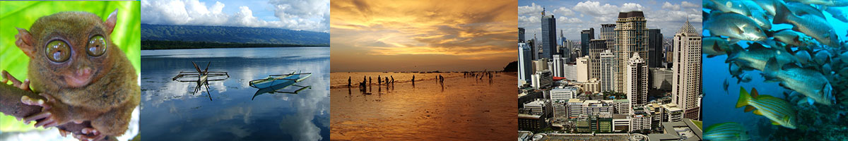
Philippines
Camiguin
Camiguin is a small island province of the Philippines off the northern coast of Mindanao. It belongs to the Northern Mindanao region. Its capital is Mambajao and it is the second-smallest province both in population and land area. Only Batanes is smaller. The island of Camiguin is in the Bohol Sea about ten kilometers north of Misamis Oriental.
Accessibility
Camiguin is accessible by air and sea from Cebu City however flights into the province's only airport is only seasonal. Most fly in to Cagayan de Oro City in Misamis Oriental Province, the gateway to Northern Mindanao. One would then take 2 more or less hours bus or hired van from Cagayan de Oro City to the port of Balingoan. Ferries leave Balingoan to Camiguin Island every hour from 6:00 am until 5:00 pm.
People and culture
The people of Camiguin are called �Camiguingnon.� The main occupation of the people is fishing and farming, with copra providing the greatest income contribution. Other plantations are abaca, rice, mangoes, lanzones and other fruit trees. Small cottage industries are increasing in number to accommodate the influx of visitors. The population is of Visayan descent. Visayan and Hiligaynon languages are widely spoken while a few speak Kinamigin. Nearly everyone speaks English fairly well.
Education
Camiguin was a center of secondary-level education in northern part of Mindanao especially before the eruption of Mt. Hibok-hibok in 1951. Several prominent people in Misamis Oriental graduated in Camiguin Institute (now Fatima College of Camiguin).
Economy
Reports from Dept. of Trade and Industry (DTI), total amount of trade and investments for the year 2001 reached to 195.645 million pesos broken down from the following sector:
* Agri-Based: PHP 28.027M
* Services: PHP 64.116M
* Consumer manufacturers: PHP 1.230M
* Others (bank releases): PHP 80.888M
* Trading: PHP 21.385MTotal: PHP 195.645 M
Geography
Political
The first governor of Misamis Oriental was Governor Pacencio Ysalina whose wife was Josefa Rodriguez Gabucan of Catarman, Camiguin. Misamis Oriental first judge was Eufrosino Palarca Limbaco of Mambajao,Camiguin, whose brother Meliton Limbaco used to be the Municipal Mayor of Mambajao, Camiguin. Dr. Jose Palarca Neri was the first Governor in the island.
MunicipalitiesCamiguin is subdivided into 5 municipalities:
* Catarman
* Guinsiliban
* Mahinog
* Mambajao
* SagayPhysical
Camiguin is composed of four young stratovolcanoes overlying older volcanic structures. One of these, Hibok-Hibok, last erupted in 1953 and is still considered active. The other major volcanic edifices are Mt. Vulcan (671 meters (2,201 ft), northwest of Hibok-Hibok), Mt. Mambajao (1,552 meters (5,092 ft), in central Camiguin), Mt. Ginsiliban (581 meters (1,906 ft), southernmost Camiguin), and Mt. Uhay (north of Mount Ginsiliban). There are also domes and cones at Campana Hill, Minokol Hill, Tres Marias Hill, Mt. Carling, Mt. Tibane, and Piyakong Hill.
History
The name Camiguin is derived from the native word �Kamagong�, a tree of the Ebony family that thrives near lake Mainit in the Province of Surigao del Norte. The original inhabitants of Camiguin were �manobos� who migrated from Surigao. The old native language in Camiguin is called �Kinamiguin�, which is similar to the dialect spoken in Surigao.
Spanish colonial era
Old Spanish documents indicate that the renowned explorers, Ferdinand Magellan and Miguel L�pez de Legazpi landed in Camiguin in 1521 and 1565, respectively. The first Spanish settlement in what was later to be known as Guinsiliban was established in 1598. Guinsiliban comes from the old Kinamiguin word �Guinsiliban� which means �to look out for pirates from a watchtower�. An old Spanish watchtower where the Camiguinon kept watch for Moro pirates still stands in Guinsiliban. The first major Spanish settlement established in 1679 was called Katagman or Katadman (known as Catarman). The settlement grew and prospered to what is now Barangay Bonbon.
On May 1, 1871, Mt. Vulcan Daan erupted and destroyed Catarman. A portion of the town sank beneath the sea. After the eruption, the settlement moved to were the town center is presently located. Today, all the remains of old Catarman are the ruins of the ancient Spanish church, a convent and a bell tower.
Sagay, located south of Catarman, was formally established as a town in 1848. The word Sagay is derived from the name of poisonous fruit tree that grow in the area. Mambajao became a town in 1855. The name was coined from the Visayan terms �mamahaw�, meaning to usher breakfast, and �bajao�, which is leftover boiled rice. In the early 1900s, Mambajao prospered to become the busiest port in Northern Mindanao. Mahinog was established as a municipality in 1860. The name Mahinog comes from a Visaya word meaning �to ripen� or �to become ripe�. Although Guinsiliban was the oldest settlement in the island, it was only in 1950 when it became a municipality. Mahinog was formerly governed by Mambajao while Guinsiliban was formally governed from Sagay.
American colonial era
In 1901, in the middle of the Philippine-American War (1898-1904), American soldiers landed in Camiguin to assume political control over the island. A group of Camiguinon, armed with bolos and spears, led by Valero Camaro fought for the island�s independence from foreign invasion during a short battle in Catarman. Valero Camaro was killed by a bullet on the forehead. He became one of the unsung Camiguin patriots of the early independence movement.
In 1903, the first public school in Camiguin was built in Mambajao and in 1904 the first public water system was installed.
World War II Battle of Camiguin Part of World War II
Date: 1945
Location: Camiguin Result: Filipino Victory
Belligerents
* Philippines Philippine Commonwealth Army * Philippines Recognized Guerrilla Units * Japan Imperial Japanese ArmyOn June 18, 1942, the Japanese Imperial Army landed in Camiguin and set up a government in Mambajao. The Japanese Army gutted down central Mambajao in reprisal to guerrilla activities that helped the Philippine Commonwealth forces there. The remains of some of these buildings still exist today.
In 1945, Philippine Commonwealth forces landed in Camiguin and liberated the Island during the Battle of Camiguin against the Japanese Imperial forces at the end of World War II .
Independence
On July 4, 1946, the country gained independence from the US and became the Republic of the Philippines. From 1946 to 1958, Camiguin was part of Misamis Oriental. In 1958, it became a sub-province and in 1968, a full-fledged province with Mambajao as its provincial capital.
From 1948 to 1951, Mt. Hibok-Hibok constantly rumbled and smoked. Its minor eruption in 1948 caused little damage and loss of life. In 1949, its eruption caused 79 deaths due to landslides. In the morning of December 4, 1951, the volcano erupted again. This, time, however, it unleashed boiling lava, poisonous gases, and landslides enough to destroy nearly 19 squares kilometers of land particularly in Mambajao. All in all, over 1,000 people were killed. Before the eruption of Mt. Hibok-Hibok in 1951, the population of Camiguin had reach 69,000. After the eruption, the population was reduced to about 34,000 due to massive out-migration.
A disastrous typhoon hit the province in the dawn of November 7, 2001. The tropical storm named 'Typhoon Nanang' brought with it watersprouts that dropped on the mountains causing multiple massive mudslides killing about 200 inhabitants, most are missing.
Camiguin was part of Misamis Oriental until 1958 when it became a sub-province. It was made into a separate province on June 18, 1966, but was formally inaugurated only in 1968.
Highlights
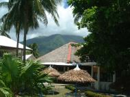
Several centuries-old churches are found in various parts of the island. One of the famous churches is the Sto. Rosario Church in the municipality of Sagay built in 1882, and the church ruins of San Roque in Barangay Bonbon. Another famous church located in Baylao is said to be miraculous during the volcanic eruption and claimed to have saved many lives. Camiguin Island is famous for the ancestral homes dotting the streets all over the island.
Each year there is a Lanzones (a small grape-sized tropical fruit) Festival held in October. The week-long festival is one of the more colorful events in the Philippines. The Lanzones festival is celebrating its 30th Anniversary on October 2009.
The stunning Katibawasan Falls and hiking trails to thrill your senses The spectacular 250-foot falls (76 m.) cascades down to a pool surrounded by orchids and ferns. Located 4 kms. from Mambajao. This is also the favorite jump-off point for trekkers and mountaineers in search of adventure in the slopes of Mt. Hibok-Hibok.
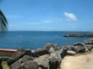
In the heart of the island bubbles the flowing mineral pools of Ardent Hot Springs. Mists rise from the heated waters running down from the vents of Hibok-Hibok Volcano, the only active one among the seven on the island. There are also a couple cold springs and a natural soda water spring on the island.
Sunken Cemetery marker
This island is also famous for its underwater sunken cemetery, submerged after a volcanic eruption of the Daan in 1871. The place is marked by a huge cross installed in 1982.
New Zealand grantOn September 2007, The Department of Environment and Natural Resources (DENR) signed a memorandum of agreement with the Camiguin provincial government for the implementation of a 5-year integrated coastal resource management system in 40 coastal barangays (villages) and 5 municipalities. Gov. Jurdin Jesus Romualdo said the 5-year project got P 116 million funding from the New Zealand Agency for International Aid (NZAID). The system includes granting of livelihood enterprises for small-scale fishermen and 10,378 households will benefit from the project.
Endemic speciesAt least four vertebrate species are believed to be endemic to Camiguin:
* Bullimus gamay, a rodent
* Apomys camiguinensis, a mouse
* Loriculus camiguinensis, the Camiguin Hanging-parrot
* Oreophryne nana, a frog.Web References:
http://en.wikipedia.org/wiki/Camiguin
http://upload.wikimedia.org/wikipedia/commons/5/5a/Camiguin_Ferry.jpg
 Editor for Asisbiz: Matthew Laird Acred
If you love our website please add a like on facebook
Please donate so we can make this site even better !!