|
 |
 |
 |
 |
 |
 |
 |
 |
 |
 |
 |
 |
 |
 |
 |
 |
 |
 |
 |
 |
 |
 |
 |
 |
 |
 |
 |
 |
 |
 |
 |
 |
 |
 |
 |
 |
 |
 |
 |
 |
 |
 |
 |
 |
 |
 |
 |
 |
 |
 |
 |
 |
 |
 |
 |
 |
 |
 |
 |
 |
 |
 |
 |
 |
 |
 |
 |
 |
 |
 |
 |
 |
 |
 |
 |
 |
 |
 |
 |
 |
 |
 |
 |
 |
 |
 |
 |
 |
 |
 |
 |
 |
 |
 |
 |
 |
 |
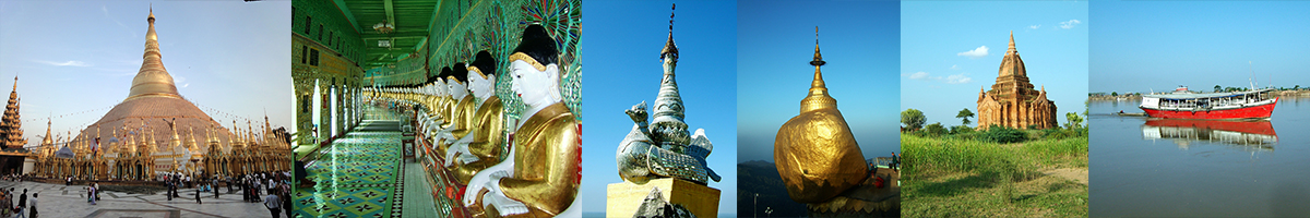
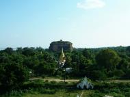
Mya Thein Tan Pagoda Hsinbyume pagoda
Mingun
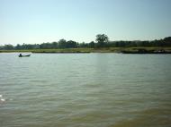
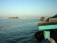
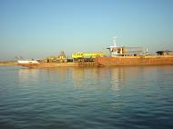
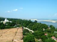
Mingun (Burmese: MLCTS: mang: kwan mrui.) is a town in Sagaing Division, northwest Myanmar (formerly Burma), located 11 km up the Ayeyarwady River on the west bank from Mandalay. Its main attraction is the ruined Mingun Pahtodawgyi, the remains of a massive unfinished Buddhist stupa begun by King Bodawpaya in 1790. The temple was not completed, due to an astrologer claiming that, once the temple was finished, the king would die. Had the stupa been completed, it would have been the largest in the world at 150 meters. Despite its ruined state, the remains are impressive, making it the largest pile of bricks in the world. There are huge cracks in the structure from the earthquake of 1838, but a small shrine with a Buddha image still serves its purpose as a place of worship and meditation. Pondaw paya or a working model of the stupa can be seen nearby.
The main attraction of Mingun are: Mingun Pahtodawgyi- It is the ruined Mingun Paya, a Buddhist temple with the remains of a massive stupa begun by King Bodawpaya in 1790. If the constrution had been completed, it would have been the largest in the world at 150 meters. It was again damaged by 1838 earthquake.
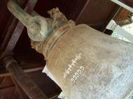
Mingun Bell- King Bodawpaya has a gigantic bell cast to go with his huge stupa. The Mingun Bell weighs 90 tons, or 55555 viss and is today the largest uncracked, ringing bell in the world. Mingun Bell is situated right next to the Mingun Pahtodawgyi. King Bodawpaya dedicated to construct a gigantic Pagoda, a gigantic bell and a gigantic lion during his reign. But he was not able to complete the pagoda.
Mya Theindan Pagoda- It is also known as Hninbyume Pagoda because it was donated by the Hsinbyume Princess, who was one the Queen of King Bodawpaya. It is just next to the Pahtodawgyi.
King Bodawpaya also had a gigantic bell cast to go with his huge stupa. The Mingun Bell weighs 90 tons, and is today the largest ringing bell in the world. The weight of the bell in Burmese measurement, is 55,555 viss or peiktha (1 viss = 1.63 kg), handed down as a mnemonic 'Min Hpyu Hman Hman Pyaw', with the consonants representing the number 5 in Burmese astronomy and numerology.
Just a couple of hundred yards from the great stupa and bell lies the beautiful white Hsinbyume or Myatheindan Pagoda with a distinctive architectural style modelled after the mythical Myinmo taung or Mount Meru, built in 1816 by Bodawpaya's grandson and successor Bagyidaw and dedicated to the memory of his first consort Princess Hsinbyume (Lady of the White Elephant, granddaughter of Bodawpaya, 1789-1812) who died in childbed.
King Bodawpaya
Bodawpaya (Thai: ปะดุง) literally Royal Grandfather, 11 March 1745 - 5 June 1819) was the sixth king of the Konbaung Dynasty of Burma (1782-1819). Born Maung Shwe Waing and later Badon Min, he was the fourth son of Alaungpaya, founder of the dynasty and the Third Burmese Empire. He was proclaimed king after deposing his nephew Phaungkaza Maung Maung, son of his oldest brother Naungdawgyi, at Ava. Bodawpaya moved the royal capital back to Amarapura in 1782. He was titled Hsinbyumyashin (Lord of the White Elephants), although he became known to posterity as Bodawpaya in relation to his successor, his grandson Bagyidaw (Royal Elder Uncle), who in turn was given this name in relation to his nephew Mindon Min. He fathered 62 sons and 58 daughters by about 200 consorts.
Military expeditions
Also known as Bodaw U Waing, he invaded Arakan in 1784 sending his royal armies led by his son, the Heir Apparent Prince of Dabayin, father of Bagyidaw and Tharrawaddy Min, across the Western Yoma range of mountains. The capital of Arakan Mrauk U was captured on 2 January 1785. The Mahamuni Buddha image, among other treasures such as the Khmer bronze statues, were brought back to mainland Burma; these can still be seen in Mandalay. Also taken were 20,000 captives as slaves to pagodas and temples, and the nobility at Amarapura. Once Arakan was annexed as a province of Burma, her borders became contiguous with British India. The Arakanese revolted in 1794, and the British Governor of India Sir John Shore (later Lord Teignmouth) sent Captain Michael Symes on an embassy, fully equipped to gather as much information as possible about the country, to the Court of Ava as the kingdom was still known to the outside world. Bodawpaya invaded Rattanakosin in 1785 resulting in defeat, and again in 1808, but failed to capture the capital. The Governor of Tavoy revolted in 1791 with the aid of the Siamese, but a punitive expedition sent by Bodawpaya by sea laid siege ending in peace negotiations in 1793 and the ceding of the Tenasserim coast to the Burmese.Religion and culture
Bodawpaya proclaimed himself the next messianic Buddha or Maitreya (Areimmadeiya), but his claim was firmly rejected by the Sangha. During his reign, scholarship flourished due to the discipline and stability achieved by establishing a chapter of Sangharajas or senior monks charged with the responsibility of safeguarding the purity of the Sangha. He had successfully arbitrated in favour of orthodoxy to cover both shoulders on the alms round in the controversy concerning the correct way of wearing the robes, and the Order of Monks was unified under the Thudhamma sect. Burma became the custodian of Buddhism in the region, and the upasampada ordination was re-introduced to Sri Lanka where it established the Amarapura Nikaya.In 1790 Bodawpaya begun the construction of a gigantic stupa called Mantalagyi (Great Royal Stupa) at Mingun, 11 km up the River Irrawaddy from Mandalay on the west bank. It was however never finished after a prophecy went round saying Payagyi lè apeethat, moksoe thonnya kap - 'Once the great pagoda has been wrought, the Moksoe dynasty will come to nought'. It was meant to have stood 150 metres, tall enough to be seen from Shwebo in the west, the birthplace of the dynasty, towering above the Minwun Hills. An earthquake in 1838 left huge fissures in the structure, and also caused the heads of the two gigantic chinthes fall into the river. It remains the largest pile of bricks in the world. There was also a gigantic 90 ton bell dedicated to the stupa called the Mingun Bell, cast between 1808 and 1810. It is the largest ringing bell in the world as the larger bell in Moscow Kremlin called the Tsar bell is broken. During his reign Bodawpaya also proved to be a great patron of the performing arts; he appointed a minister called Thabin Wun, and established strict regulations by royal decree (Ameintdaw). He also ordered a major economic survey of the kingdom in 1784.
Bodawpaya was succeeded after his death in 1819 by his grandson Sagaing Min (Prince of Sagaing) who later became known as Bagyidaw. The Heir Apparent, father of Bagyidaw, had died in 1808.
Web reference:
https://en.wikipedia.org/wiki/MingunThe Mingun Bell
The Mingun Bell is a bell located in Mingun, Sagaing division, Myanmar. It is located in some 11 km (7 miles) north of Mandalay on the western bank of the Ayeyarwady river. The casting of the bell started in 1808 and finished in 1810. King Bodawpaya (1745-1819) had this gigantic bell cast to go with his huge stupa, Mingun Pahtodawgyi. The Mingun Bell weighs 90 tons, and is today the largest ringing bell in the world. The weight of the bell in Myanmar measurement, is 55,555 viss or peiktha (1 viss = 1.63 kg), handed down as a mnemonic 'Min Hpyu Hman Hman Pyaw', with the consonants representing the number 5 in Burmese astronomy and numerology. The bell is uncracked and in good ringing condition. The weight of the bell and its mnemonic words are written on the surface of the bell in white.
The outer diameter of the rim of the bell is 16 feet and 3 inches. The height of the Bell is 12 feet on the exterior and 11.5 feet in the interior. The outside circumference at the rim is 50.75 feet. The Bell is 6 inches to 12 inches thick and stands 20.7 feet high from the rim to the top.
Sagaing Division
Sagaing Division is an administrative division of Myanmar, located in the north-western part of the country between latitude 21° 30' north and longitude 94° 97' east. It is bordered by India’s Nagaland and Manipur States to the north, Kachin State, Shan State, and Mandalay Division to the east, Mandalay Division and Magway Division to the south, with the Ayeyarwady River forming a greater part of its eastern and also southern boundary, and Chin State and India to the west. The division has an area of 93,527 km², and population (1996) of over 5,300,000. The capital is Sagaing.
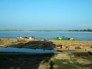
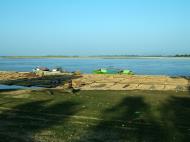
Sagaing Division consists of 198 wards and villages, 38 townships and eight districts; Sagaing, Shwebo, Monywa, Katha, Kale, Tamu, Mawlaik and Hkamti. The major cities are Sagaing, Monywa, Shwebo, Katha, Kale, Tamu, Mawlaik and Hkamti. Mingun with its famous bell is located near Sagaing but can be reached across the Ayeyarwady from Mandalay.
History
The Pyu were the first to in recorded history to populate the area of Sagaing Division by the 1st century CE. The Bamar (Burmans) first migrated into Upper Myanmar by 7th century CE. The area came under the Pagan Kingdom certainly by the middle of 11th century when King Anawrahta (r. 1044-1077) founded the Pagan Empire, which encompasses the modern day Myanmar.After the fall of Pagan in 1287, the northwestern parts of Upper Myanmar came under the Sagaing Kingdom (1315-1364) ruled by Burmanized Shan kings. The area was ruled by the kings of Ava from 1364 to 1555 and the kings of Taungoo from 1555 to 1752. Konbaung Dynasty (1752-1885), founded by king Alaungpaya in Shwebo, became the last Burmese dynasty before the British conquest of Upper Burma in 1885. The area became Sagaing Division after the Burmese independence in January 1948.
Demographics
Sagaing
The Bamar (Burmans) are the majority ethnic group in the dry regions and along the Mandalay-Myitkyina Railroad. Shan live in the upper Chindwin River valley. A sizable minority of Naga resides in the north of north-west mountain ranges and Chin in the south. Smaller ethnic groups native to the Division include the Kadu and Ganang, who live in the upper Mu River valley and Meza River valley.
Economy
Agriculture is the chief occupation. The leading crop is rice, which occupies most of the arable ground. Other crops include wheat, sesame, peanut, pulses, cotton, and tobacco. Sagaing is Myanmar’s leading producer of wheat, contributing more than 80% of the country's total production. Forestry is important in the wetter upper regions along the Chindwin River, with teak and other hardwoods extracted. As in other parts of the country, reforestation is not effective enough to maintain sustainable forestry. Important minerals include gold, coal, salt and small amounts of petroleum. Industry includes textiles, copper refining, gold smelting, and a diesel engine plant. The Division has many rice mills, edible oil mills, saw mills, cotton mills, and mechanized weaving factories. Local industry includes earthen pots, silverware, bronze-wares, iron-wares and lacquerware.
Web reference: https://en.wikipedia.org/wiki/Sagaing_Division
Myatheindan Pagoda, Myanmar (Burma) Map
 Editor for Asisbiz: Matthew Laird Acred
If you love our website Please donate so we can make this site even better !!
Please donate so we can make this site even better !!