 |
 |
 |
 |
 |
 |
 |
 |
 |
 |
 |
 |
 |
 |
 |
 |
 |
 |
 |
 |
 |
 |
 |
 |
 |
 |
 |
 |
 |
 |
 |
 |
 |
 |
 |
 |
 |
 |
 |
 |
 |
 |
 |
 |
 |
 |
 |
 |
 |
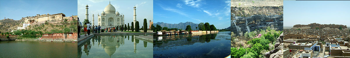
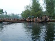
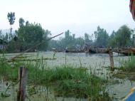
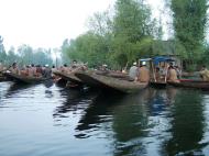
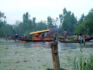
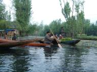
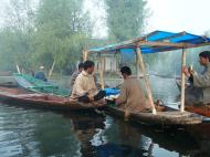
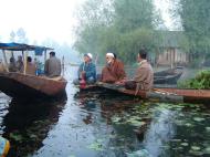
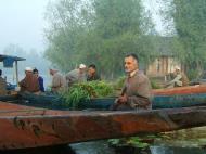
Floating Vegetable Markets Mal Canal
A must see for locals and tourists alike. The only trouble its an early start but a beautiful to start the day.
Srinagar श्रीनगर – श्रीनगर – سِرېنَگَر - شرینگر
Srinagar (Dogri: श्रीनगर; Kashmiri: श्रीनगर, سِرېنَگَر ; Urdu: شرینگر), is the capital of the northernmost state of Jammu and Kashmir that is situated in India. It is situated in Kashmir Valley and lies on the banks of the Jhelum River, a tributary of the Indus. The city is famous for its lakes and houseboats. It is also known for traditional Kashmiri handicrafts and dry fruits. It is also the headquarters of Srinagar district.
Origin of name
Etymologically Srinagar is composed of two Sanskrit words, namely, Sri (meaning abundance and wealth) and Nagar, which means a city. Thus, the word Srinagar signifies a place of wealth and abundance. Sri is also the name of a goddess Lakshmi of Hindus.
A legend, as incorporated in Nila’s Nilmatapurana, states that the Kashmir valley was a vast lake. A Hindu sage named Kashyapa drained out the water, and there emerged the beautiful valley of Kashmir.
History
The city was founded by the King Pravarasena II over 2,000 years ago, and the city of Srinagar has a long history, dating back at least to the 3rd century BC. The city was then a part of the Maurya Empire, one of the largest empires of the Indian subcontinent. Ashoka introduced Buddhism to the Kashmir valley, and the adjoining regions around the city became a centre of Buddhism. In the 1st century, the region was under the control of Kushans and several rulers of this dynasty strengthened the Buddhist tradition. Vikramaditya (of Ujjain) and his successors probably ruled the regions just before the city fell to the control of the Huns in the 6th century, and Mihirkula was the most dreaded ruler of the city and the valley.
The Hindu and the Buddhist rule of Srinagar lasted until the 14th century, when the Kashmir valley, including the city, came under the control of the several Muslim rulers, including the Mughals. It was also the capital during the reign of Yusuf Shah Chak, a ruler who was tricked by Akbar when he failed to conquer Kashmir by force. Yusuf Shah Chak remains buried in Bihar in India. Akbar established Mughal rule in Srinagar and Kashmir valley.
When the disintegration of the Mughal Empire set forth after the death of Aurangzeb in 1707, infiltrations to the valley from the Pashtun tribes increased, and the Durrani Empire ruled the city for several decades. Raja Ranjit Singh in the year 1814 annexed a major part of the Kashmir Valley, including Srinagar, to his kingdom, and the city came under the influence of the Sikhs. In 1846, the Treaty of Lahore was signed between the Sikh rulers and the British in Lahore. The treaty, inter alia, provided British de-facto suzerainty over the Kashmir Valley, and installed Gulab Singh as an independent and sovereign ruler of the region. Srinagar became part of his kingdom, and remained until 1947 as one of the several princely states of undivided India.
After, India's independence, certain tribes, mostly Pashtun, actively supported by elements of the Pakistani forces, Indo-Pakistani War of 1947 came to the valley to help the local overwhelming Muslim majority of Srinagar and the whole of Kashmir to gain independence from the Hindu Dogra Ruler. While the Pakistan Army gained control of the majority of Srinagar it was not able to secure Srinagar Airport. This allowed India to air lift the Indian Army along with all the heavy weapons and they were able to capture the city and its surroundings. In view of infiltration by armed forces and the possibility of his kingdom, including the city of Srinagar falling into civil war, Hari Singh signed a covenant in late 1947 with the Government of India, which ensured integration of his kingdom into the newly formed Republic of India, conditioned on the requirement of having a plebiscite after any conflict had ended. Various historians, notably British historian Alaister Lamb, dispute the claim that the Maharaja signed any agreement at all.
The Government of India, in view of its obligation enjoined upon it subsequent to this covenant, immediately air-lifted Indian troops to Srinagar, and the city was prevented by the Indian Army. In the meanwhile, the matter had been escalated to the United Nations, and a cease fire was imposed under its authority, resulting into certain parts of Hari Singh's kingdom going out of his hands, which now constitutes the Azad Kashmir state under Pakistani administration. The British Historian Alaister Lamb in his book claims that the troops were flown into Srinagar even before the alleged covenant was signed, his claims were proven after the agreement was found illegal.
Geography
The city is located on both the sides of the Jhelum River, which is called Vyath in Kashmir. The river passes through the city and meanders through the valley, moving onward and deepening in the Wular Lake. The city is famous for its nine old bridges, connecting the two parts of the city.
Hokersar is a wetland situated near Srinagar—the capital of Indian Kashmir. Thousands of migratory birds come to Hokersar from Siberia and other regions in the winter season. Migratory birds from Siberia and Central Asia use wetlands in Kashmir as their transitory camps between September and October and again around spring. These wetlands play a vital role in sustaining a large population of wintering, staging and breeding birds.
Hokersar is 14 kilometres (8.7 mi) north of Srinagar, and is a world class wetland spread over 13.75 square kilometres (5.31 sq mi) including lake and marshy area. It is the most accessible and well-known of Kashmir's wetlands which include Hygam, Shalibug and Mirgund. A record number of migratory birds have visited Hokersar in recent years. An estimated quarter of a million birds have already been spotted at Hokersar in the current season.
Birds found in Hokersar — Migratory ducks and geese which include Brahminy Duck, Tufted Duck, Gadwall, Garganey, Greylag Goose, Mallard, Common Merganser, Northern Pintail, Common Pochard, Ferruginous Pochard, Red-Crested Pochard, Ruddy Shelduck, Northern Shoveler, Common Teal, and Eurasian Wigeon.
Climate
The climate of Srinagar may be generally described as warm temperate. The city has warm summers from June through August, and winters from December-February. The city generally gets some snowfall from December to February but seldom accumulates for longer periods. The average temperatures are 24 °C (75 °F) in July (ranging between 18 to 29°C or 65 to 84°F) and 4 °C (39 °F) in January (between -2/7°C or 28/45°F (night/day), -2/0°C or 28/32°F and 7/11°C or 45/52°F some of local extremes).
Economy
Srinagar is the most pivotal centre of the economy of the Kashmir Valley, and it has remained a tourist destination for centuries. The Kashmir Valley has attracted various Indian rulers over the decades, who would come to avoid the hot summers of the Indo-Gangetic plains. The Mughal ruling elite, and several Mughal emperors have helped developed many of the gardens that can now be seen in and around Srinagar.
With the colonization of India by the Europeans, particularly the British, the ruling elite as well as the rich Indians used to visit the city and the nearby locations during summers to avoid heat of the plains; and during winters to enjoy the snowfall.
The hinterland of Srinagar is the most populous part of the Kashmir valley, and crops like wheat and rice are cultivated for local consumption. Orchards produce a number of fruits, particularly apples. Another significant segment of the economy, include handicrafts, weaving of woolen shawls and dress materials, and woodcarving. Srinagar and the surrounding areas serve as collecting points from where fruits and handicraft products are taken to several parts of the Indian subcontinent.
Tourism
Tourism is the most significant segment of the city's economy. The city of Srinagar is a gateway to some of the most scenic and beautiful places of the Indian subcontinent. The beautiful and world famous hill station and skiing resort Gulmarg is just 50 km from the city. For decades, tourism has been contributing massively to the economy of the city, but it has been adversely affected on account of insurgent activities by certain elements.
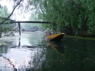
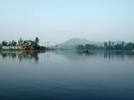
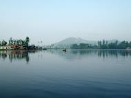
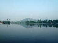
Srinagar is well known for its lakes. Dal Lake with its houseboats is famous all over the world. Srinagar is a small and beautiful city with a wonderful climate in the summer. Nagin Lake is another famous lake in the city.
Just outside the city are found the beautiful Shalimar Gardens created by Jehangir, the Mughal emperor, in 1619.
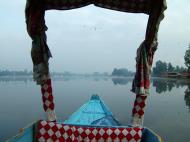
Houseboats were introduced accidentally to Kashmir: members of the Indian Civil Service serving in the plains who vacationed in Kashmir were not permitted to build permanent homes because of the then Maharaja's suspicion of a British presence in Srinagar. They thus chose to live in houseboats. The first such, named Victory, was designed by Mr. M.T. Kenhard in 1888. There are now about five hundred on the Lake.
Srinagar has several gardens which are part of the several such gardens laid by the Mughal emperors across the Indian subcontinent, and which are known as Mughal gardens. The Mughal Gardens located in Srinagar and its close vicinity include Chasma Shahi (the royal fountains); Pari Mahal (the palace of the fairies); Nishat Bagh (the garden of spring); Shalimar Bagh; and the Nashim Bagh. The Tulip Gardens have been recently opened to public by Smt Sonia Gandhi. The gardens has rows of Tulips of different colurs and shades.
Government and politics
The city is run by the Srinagar Municipal Committee (SMC). The Srinagar district along with the adjoining Budgam district forms the Srinagar Parliamentary seat. Current leaders of the city include:
* Omar Abdullah, Chief Minister of Jammu & Kashmir (NC)
* Saifuddin Soz, Pesident Pradesh Congress (Jammu & Kashmir) and Union Minister for Water Resources Development
* Ghulam Nabi Azad, Former Chief Minister of Jammu and Kashmir (Cong)
* Farooq Abdullah, Former Chief Minister and President of National Conference
* Syed Ali Shah Geelani, Chairman and Patron of All Parties Hurriyat Conference (APHC) (G)
* Yasin Malik, Chairman, Jammu and Kashmir Liberation Front (JKLF)
* Mufti Mohammad Sayeed, Former Chief Minister, Former Union Home Minister and Patron of Peoples Democratic Party
* Mehbooba Mufti, President Peoples Democratic Party
* Sadiq Ali, Senior Shia leader, and former MLA.
* Mirwaiz Omar Farooq, Chairman Awami Action Committee and APHC(M)Stray Dog Controversy
Srinagar's city government attracted brief international attention in March 2008 when it announced a mass poisoning program aimed at eliminating the city's population of stray dogs. Officials estimate that 100,000 stray dogs roam the streets of the city, which has a human population of just under 900,000. In a survey conducted by an NGO, it was found that some residents welcomed this program, saying the city was overrun by dogs, while critics contended that more humane methods could have been used to deal with the animals.
Demographics
As of 2001, Srinagar city had a population of 894,940. The population density in the city is 556 inhabitants per square kilometre (1,440 /sq mi) while the overall population density is 99 /km² (260 /sq mi). The languages spoken are mainly Kashmiri, Urdu, Hindi and English. Muslims make up 99% of the population
Culture
Like the state of Jammu and Kashmir, Srinagar too has a distinctive blend of cultural heritage. Holy places in and around the city depict the historical cultural and religious diversity of the city as well as the Kashmir valley.
Places of worship
Holy places of the city include:
The Shankaracharya temple built in around 200 B.C* Hazratbal Shrine
* Jama Masjid, Srinagar, one of the oldest mosques in Kashmir
* Khanqah Moulla The mosque founded by the sufi saint Hazrat Shah-i-Hamadan
* Kheer bhawani
* Dasgeer Sahib Khanyar,Shrine of Saint Sheikh Abdul Qadir Jeelani(R.A)
* BulBul Saheb Shrine Of Saint Sheikh Abdul Rahman (R.A)
* Hari Parbat hill hosts shrine of Sufi Saint Sheikh Hamza Makdoom(R.A)
* Zestha
* Shankaracharya temple,on Sulaiman Hill
* Chari Sharief
* Baba Reshi, Tangmarg
* Rozabal Mosque
* Roza BalPerforming arts
Performing arts of the city include:
* Bhand Pather, a form of traditional folk theatre art form of play and dance, is performed by a group of about ten to fifteen artists. They depict in a satirical style social evils. Performance is accompanied by light music.
* Chakri is a major and popular form of Kashmiri folk music.
* Another form of Kashmiri genre of music called Sufiana music is also practiced in the city. It was introduced in the valley in the 15th century from Iran. Over centuries, it has assimilated a number of Indian Ragas, and has established itself as a classical music of the region. The instruments used in the music include Santoor, Sitar, Kashmiri Saz, Tabla, and Wasool.
* Hafiz Nagma, a form of dance, is performed to the accompaniment of Sufiana music. The dancer is a female while males play different instruments used in Sufiana music.Education
* Government Medical College, Srinagar
* National Institute of Technology, Srinagar
* University of Kashmir, Srinagar
* Islamic University of Science & Technology
* Sher-e-Kashmir University of Agricultural Sciences and Technology of Kashmir (SKUAST-K)
* Sri Pratap School (Est.1898)
* Sri Pratap College (Est.1905)
* Amar Singh College (Est.1942)
* Islamia College Of Science & Commerce
* SSM College of Engineering Parishaspora Pattan
* Government Women's Polytechnic, Bemina
* Sikkim Manipal University - LC 1009, Parraypora New Airport Road
* D.A.V Institute Magarmal Bagh/Jawahar Nagar
* Govt. Boys Polytechnic, Rajbagh
* New Era Public School
* Army Public School
* Mallinson School
* Minto Circle School/Raj Bagh
* Tyndale Biscoe School (Est.1880)
* Presentation Convent High School
* Greenland School
* Government Women's College - M.A Road/Nawa Kadal
* Burn Hall School
* Jhelum Valley medical college
* Wood Lands House School
* Iqbal Memorial Institute
* Oak Hill School
* Modern High School
* D.A.V Higher secondary School jawahar nagar.
* S.M.D. High School - Munawar-abad, Khayam Road, Srinagar
* Lal Ded Memorial School - Badiyar-e-Balla, Ganpatyar, Habba Kadal, Srinagar.
* Gandhi Memorial Collage, Srinagar.
* Dream Land Edu. Inst. Ganderbal
* R.P School Boys and girls Malabag Naseembagh
* Tiny Harts School, Tengpora
* Muslim Educational Trust, Baghat-i-Barzulla
* Dar-ul-uloom Bilalia Lalbazar Srinagar.Media
Four FM frequencies are available in the city. However, only two bids were received by the government. Adlabs is the only FM radio operator in Srinagar (its bid was Rs. 61 lakh). The second bidder South Asia FM did not qualify because its bid was less than 25 per cent of the highest bidder, the minimum amount to be eligible for bidding.
Sports
Adventure sports are popular among tourists. Dal Lake has potential for canoeing and water skiing. Water trekking is local name for three to four day trip along the Jhelum River to various lakes in a shikara with camping gear. Dachigam National Park (22 km/14 mi) and Pahalgam (95 km/59 mi) are popular destinations for hikers, trekkers and fishers. The city is home to the Sher-i-Kashmir Stadium, a stadium where international cricket matches have been played.
Sports like football and cricket are popular among schoolchildren.
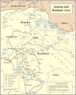
Jammu and Kashmir जम्मू और कश्मीर جموں و کشمیر
Jammu and Kashmir (Dogri: जम्मू और कश्मीर; Urdu: جموں و کشمیر) is the northernmost state of India. It is situated mostly in the Himalayan mountains. Jammu and Kashmir shares a border with the People's Republic of China to the northeast, the states of Himachal Pradesh and Punjab to the south and Pakistani-administered territories of Kashmir, namely Azad Kashmir and the Northern Areas to the west and northwest respectively. Formerly a part of the erstwhile princely state of Jammu and Kashmir, this territory is disputed between China, India and Pakistan. Jammu and Kashmir is referred to in Pakistan as Indian-occupied Kashmir, and some international agencies refer as Indian-administered Kashmir.
Jammu and Kashmir consist of three regions: Jammu, the Kashmir valley and Ladakh. Srinagar is the summer capital, and Jammu, its winter capital. While the Kashmir valley, often known as Paradise on Earth, is famous for its beautiful mountainous landscape, Jammu's numerous shrines attracts tens of thousands of Hindu and Muslim pilgrims every year. Ladakh, also known as ‘Little Tibet’, is renowned for its remote mountain beauty and Buddhist culture.
History
The Valley of Kashmir was once the great lake Satisar. According to Hindu texts, the Hindu sage Kashyapa drained a lake lying north of the Pir Panjal Range by cutting the mountain near Varamulla. The sage then encouraged people from India to settle in the valley that was formed after the lake was drained. The locals named the valley Kashyap-Mar and Kashyap-Pura in honour of the sage. The name Kashmir is derived from ka (the water) and shimeera (to desiccate), so the word Kashmir implies land desiccated from water. The lake was very holy to the population until it drained.
Kashmir was one of the major centres for Sanskrit scholars in ancient times. According to evidence from the Mahābhārata, the Kambojas had ruled over Kashmir during epic times, following a republican system of government. The capital city of Kashmir during epic times was Rajapura, which is the same as Ho-lo-she-pu-lo of Yuan Chawang and has been identified with modern Rajauri. Later, the Panchalas are stated to have established their sway. The name of the Pir Panjal range, which is a part of modern Kashmir, is a distorted form of the Sanskritic tribal term Panchala. The Muslims later prefixed the word peer to it in memory of Siddha Faqir and the name thereafter changed into Pir Panjal.
The Kashmir valley was first incorporated into the Maurya Empire and then into the Kushan Empire. In the early 8th century, Kashmir became the center of Hindu warrior Lalitaditya Muktapida's empire spanning much of northern India and Central Asia. Kashmir was invaded in mid 12th century by the Muslim Turkish army but it was completely occupied by Turkish Zulkadur Khan in 1322. Later in 1394, another Turkish occupation took place by Sikandar who made Islam the state religion. Udayan Dev was the last Kashmiri ruler but after his death in 1338, Kashmir was completely occupied by the Turks. Turkish rule ended when the Mughal Emperor Akbar invaded Kashmir in 1586, led by Hindu King Bhagawant Das and his aide Ramchandra I. The Mughal army defeated Yusuf Khan of Kashmir. After the battle, Akbar appointed Ramchandra I as the governor of the Himalayan kingdom. Ramchandra I founded the city of Jammu (named after Hindu goddess Jamwa Mata) south of the Pir Panjal range.
In 1780, after the death of Ranjit Deo, a descendant of Ramchandra I, Jammu and Kashmir was captured by the Sikhs under Ranjit Singh of Lahore and afterwards, until 1846, became a tributary to the Sikh power. Ranjit Deo's grandnephew, Gulab Singh, subsequently sought service at the court of Ranjit Singh, distinguished himself in later wars, and was appointed as the Governor or Raja of Jammu in 1820. With the help of his able officer, Zorawar Singh, Gulab Singh soon captured Ladakh and Baltistan, regions to the east and north-east of Kashmir.
In 1845, the First Anglo-Sikh War broke out, and Gulab Singh contrived to hold himself aloof till the battle of Sobraon (1846), when he appeared as a useful mediator and the trusted advisor of Sir Henry Lawrence. Two treaties were concluded. In the first, the State of Lahore (i.e. West Punjab) was handed over to the British, for an equivalent amount to one crore rupees of indemnity, the hill countries between the Beas River and the Indus River; by the second the British made over to Gulab Singh for 75 lakhs rupees all the hilly or mountainous country situated to the east of the Indus River and west of the Ravi River’ (i.e., the Vale of Kashmir). Soon after Gulab Singh's death in 1857, his son, Ranbir Singh, added the emirates of Hunza, Gilgit and Nagar to the kingdom.
Hari Singh (Ranbir Singh's grandson) had ascended the throne of Kashmir in 1925 and was the reigning monarch at the conclusion of British rule in the subcontinent in 1947. As a part of the partition process, both countries had agreed that the rulers of princely states would be given the right to opt for either Pakistan or India or—in special cases—to remain independent. In 1947, Kashmir's population ‘was 77 per cent Muslim and it shared a boundary with Pakistan. On 20 October Pakistan violating the Stand-Still agreement invaded Jammu & Kashmir. Initially the Maharaja fought back but on 27 October appealed to Mountbatten for assistance, and the Governor-General agreed on the condition that the ruler accede to India.’ Once the papers of accession to India were signed, Indian soldiers entered Kashmir with orders to stop any further occupation, but they were not allowed to expel anyone from the state. India took the matter to the United Nations. The UN resolution asked Pakistan to vacate the areas it has occupied and asked India to assist the U.N. Plebiscite Commission to organize a plebiscite to determine the will of the people. Pakistan refused to vacate the occupied areas.
Diplomatic relations between India and Pakistan soured for many other reasons, and eventually resulted in three further wars in Kashmir the Indo-Pakistani War of 1965, the Indo-Pakistan War of 1971 and the Kargil War in 1999. India has control of 60 percent of the area of the former princely state of Jammu and Kashmir; Pakistan controls 30 percent of the region, collectively known as Pakistan-administered Kashmir and China has since occupied 10 percent of the state in 1962. According to Encyclopedia Britannica,
Although there was a clear Muslim majority in Kashmir before the 1947 partition and its economic, cultural, and geographic contiguity with the Muslim-majority area of the Punjab (in Pakistan) could be convincingly demonstrated, the political developments during and after the partition resulted in a division of the region. Pakistan was left with territory that, although basically Muslim in character, was thinly populated, relatively inaccessible, and economically underdeveloped. The largest Muslim group, situated in the Vale of Kashmir and estimated to number more than half the population of the entire region, lay in Indian-administered territory, with its former outlets via the Jhelum valley route blocked.
The eastern region of the erstwhile princely state of Kashmir has also been beset with a boundary dispute. In the late 19th- and early 20th centuries, although some boundary agreements were signed between Great Britain, Tibet, Afghanistan and Russia over the northern borders of Kashmir, China never accepted these agreements, and the official Chinese position did not change with the communist takeover in 1949. By the mid-1950s the Chinese army had entered the north-east portion of Ladakh: By 1956–57 they had completed a military road through the Aksai Chin area to provide better communication between Xinjiang and western Tibet. India's belated discovery of this road led to border clashes between the two countries that culminated in the Sino-Indian war of October 1962. China has occupied Aksai Chin since 1962 and, in addition, an adjoining region, the Trans-Karakoram Tract was ceded by Pakistan to China in 1963.
For intermittent periods between 1957, when the state approved its own Constitution to the death of Sheikh Abdullah in 1982, the state had alternating spells of stability and discontent. In the late 1980s however, simmering discontent over the high-handed policies of the Union Government and allegations of the rigging of the 1987 assembly elections triggered a violent uprising which was backed by Pakistan. Since then, the region has seen a prolonged, bloody conflict between militants and the Indian Army. Both the militants and the army have been accused of widespread human rights abuses, including abductions, massacres, rape and looting.
Geography and climate
Jammu and Kashmir is home to several valleys such as the Kashmir Valley, Tawi Valley, Chenab Valley, Poonch Valley, Sind Valley and Lidder Valley. The main Kashmir valley is 100 km (62 mi) wide and 15,520.3 km2 (5,992.4 sq mi) in area. The Himalayas divide the Kashmir valley from Ladakh while the Pir Panjal range, which encloses the Valley from the west and the south, separates it from the Great Plains of northern India. Along the northeastern flank of the Valley runs the main range of the Himalayas. This densely settled and beautiful valley has an average height of 1,850 metres (6,100 ft) above sea-level but the surrounding Pir Panjal range has an average elevation of 5,000 metres (16,000 ft).
The Jhelum River is the only major Himalayan river which flows through the Kashmir valley. The Indus, Tawi, Ravi and Chenab are the major rivers flowing through the state. Jammu and Kashmir is home to several Himalayan glaciers. With an average altitude of 5,753 metres (18,870 ft) above sea-level, the Siachen Glacier is 70 km (43 mi) long making it the longest Himalayan glacier.
The climate of Jammu and Kashmir varies greatly owing to its rugged topography. In the south around Jammu, the climate is typically monsoonal, though the region is sufficiently far west to average 40 to 50 mm (1.6 to 2 inches) of rain per months between January and March. In the hot season, Jammu city is very hot and can reach up to 40 °C (104 °F) whilst in July and August, very heavy though erratic rainfall occurs with monthly extremes of up to 650 millimetres (25.5 inches). In September, rainfall declines, and by October conditions are hot but extremely dry, with minimal rainfall and temperatures of around 29 °C (84 °F).
Across from the Pir Panjal range, the South Asian monsoon is no longer a factor and most precipitation falls in the spring from southwest cloudbands. Because of its closeness to the Arabian Sea, Srinagar receives as much as 25 inches (635 millimetres) of rain from this source, with the wettest months being March to May with around 85 millimetres (3.3 inches) per month. Across from the main Himalaya Range, even the southwest cloudbands break up and the climate of Ladakh and Zanskar is extremely dry and cold. Annual precipitation is only around 100 mm (4 inches) per year and humidity is very low. This region, almost all above 3,000 metres (9,750 ft) above sea level and winters are extremely cold. In Zanskar, the average January temperature is -20 °C (-4 °F) with extremes as low as -40 °C (-40 °F). All the rivers freeze over and locals actually do river crossings during this period because their high levels from glacier melt in summer inhibits crossing. In summer in Ladakh and Zanskar, days are typically a warm 20 °C (68 °F) but with the low humidity and thin air nights can still be cold.
Divisions
Jammu and Kashmir consists of three divisions: Jammu, Kashmir Valley and Ladakh, and is further divided into 22 districts: The Siachen Glacier, although under Indian military control, does not lie under the administration of the state of Jammu and Kashmir. Kishtwar, Ramban, Reasi, Samba, Bandipora, Ganderbal, Kulgam and Shopian are newly formed districts.
Jammu region
1. Kathua District
2. Jammu District
3. Samba District
4. Udhampur District
5. Reasi District
6. Rajouri District
7. Poonch District
8. Doda District
9. Ramban District
10. Kishtwar DistrictKashmir Valley region
11. Anantnag District
12. Kulgam District
13. Pulwama District
14. Shopian District
15. Budgam District
16. Srinagar District
17. Ganderbal District
18. Bandipora District
19. Baramulla District
20. Kupwara DistrictLadakh region
21. Kargil District
22. Leh DistrictDemographics
Population Growth
Census : Pop. : %±
1951 : 3,254,000 :
—
1961 : 3,561,000 : 9.4%
1971 : 4,617,000 : 29.7%
1981 : 5,987,000 : 29.7%
1991 : 7,837,000 : 30.9%
2001 : 10,144,000 : 29.4%
Source:Census of IndiaJammu and Kashmir is the only state in India that has a Muslim majority population. Though Islam is practiced by about 67% of the population of the state and by 97% of the population of the Kashmir valley, the state has large and vibrant communities of Buddhists, Hindus and Sikhs. In Jammu, Hindus constitute 65% of the population and Muslims 31% and Sikhs, 4%; In Ladakh, Buddhists constitute about 46% of the population, the remaining being Muslims. The people of Ladakh are of Indo-Tibetan origin, while the southern area of Jammu includes many communities tracing their ancestry to the nearby Indian states of Haryana and Punjab, as well as the city of Delhi. In totality, the Muslims constitute 67% of the population, the Hindus about 30%, the Buddhists 1%, and the Sikhs 2% of the population.
In the 1901 Census of the British Indian Empire, the population of the princely state of Kashmir was 2,905,578. Of these 2,154,695 were Muslims, 689,073 Hindus, 25,828 Sikhs, and 35,047 Buddhists. The Hindus were found mainly in Jammu, where they constituted a little less than 50% of the population. In the Kashmir Valley, the Hindus represented ‘only 524 in every 10,000 of the population (i.e. 5.24%), and in the frontier wazarats of Ladhakh and Gilgit only 94 out of every 10,000 persons (0.94%).’ In the same Census of 1901, in the Kashmir Valley, the total population was recorded to be 1,157,394, of which the Muslim population was 1,083,766, or 93.6% of the population. These percentages have remained fairly stable for the last 100 years. In the 1941 Census of British India, Muslims accounted for 93.6% of the population of the Kashmir Valley and the Hindus constituted 4%. In 2003, the percentage of Muslims in the Kashmir Valley was 95% and those of Hindus 4%; the same year, in Jammu, the percentage of Hindus was 67% and those of Muslims 27%.
In the same Census of 1901, four divisions were recorded among the Muslims of the princely state: Shaikhs, Saiyids, Mughals, and Pathans. The Shaikhs were the most numerous, with clan names (known as krams) including ‘Tantre,’ ‘Shaikh,’ ‘Mantu,’ ‘Ganai,’ ‘Dar,’ ‘Damar,’ ‘Lon’ etc. The Saiyids, it was recorded ‘could be divided into those who follow the profession of religion and those who have taken to agriculture and other pursuits. Their kram name is ‘Mir.’ While a Saiyid retains his saintly profession Mir is a prefix; if he has taken to agriculture, Mir is an affix to his name.’ The Mughals who were not numerous were recorded to have kram names like ‘Mir’ (a corruption of ‘Mirza’), ‘Beg,’ ‘Bandi,’ ‘Bach,’ and ‘Ashaye.’ Finally, it was recorded that the Pathans ‘who are more numerous than the Mughals, .. are found chiefly in the south-west of the valley, where Pathan colonies have from time to time been founded. The most interesting of these colonies is that of Kuki-Khel Afridis at Dranghaihama, who retain all the old customs and speak Pashtu.’
The Hindu population of Kashmir Valley in 1901 was recorded to be 60,641. Among the Hindus of Jammu province, who numbered 626,177 (or 90.87% of the Hindu population of the princely state), the most important castes recorded in the census were ‘Brahmans (186,000), the Rajputs (167,000), the Khattris (48,000) and the Thakkars (93,000).’ According to political scientist Alexander Evans, approximately 95% of the total population of 160,000-170,000 of Kashmiri Brahmins, also called Kashmiri Pandits, (i.e. approximately 150,000 to 160,000) left the Kashmir Valley in 1990 as militancy engulfed the state. According to an estimate by the Central Intelligence Agency, about 300,000 Kashmiri Pandits from the entire state of Jammu and Kashmir have been internally displaced due to the ongoing violence.
Division : Population : % Muslim : % Hindu : % Sikh : % Buddhist/Other
Kashmir (53.9%) : 5,476,970 : 97.16% : 1.84% : 0.88% : 0.11%
Jammu (43.7%) : 4,430,191 : 30.69% : 65.23% : 3.57% : 0.51%
Ladakh (2.3%) : 236,539 : 47.40% : 6.22% : – : 45.87%
Jammu & Kashmir : 10,143,700 : 66.97% : 29.63% : 2.03% : 1.36%
Statistics calculated from the 2001 Census India District ProfilesAn estimated 50-100,000 Kashmiri Muslims and 150-300,000 Kashmiri Pandits have been internally displaced due to militancy.
In Jammu and Kashmir, the principal spoken languages are Kashmiri, Urdu, Dogri, Pahari, Balti, Ladakhi, Punjabi, Gojri and Dadri, Kishtwari. However, Urdu written in the Persian script is the official language of the state. Many speakers of these languages use Hindi or English as a second language.
Politics and government
Jammu and Kashmir is the only state in India which enjoys special autonomy under Article 370 of the Constitution of India according to which, no law enacted by the Parliament of India, except for those in the field of defense, communication and foreign policy, will be extendable in Jammu and Kashmir unless it is ratified by the state legislature of Jammu and Kashmir. Subsequently, jurisdiction of the Supreme Court of India over Jammu and Kashmir has been extended. Jammu and Kashmir is also the only Indian state that has its own flag and constitution, and Indians from other states cannot purchase land or property in the state. Designed by the then ruling National Conference, the flag of Jammu and Kashmir features a plough on a red background symbolizing labor substituted the Maharaja's state flag. The three stripes represent the three distinct administrative divisions of the state, namely Jammu, Valley of Kashmir, and Ladakh.
Since 1990, the Armed Forces Act, which gives special powers to the Indian security forces, has been enforced in Jammu and Kashmir. The decision to evoke this act was criticized by the Human Rights Watch.
Like all the states of India, Jammu and Kashmir has a multi-party democratic system of governance. Influential political parties include the Jammu & Kashmir National Conference (NC), the Indian National Congress (INC), the Jammu and Kashmir People's Democratic Party (PDP), the Bharatiya Janata Party (BJP) and other smaller regional parties. After dominating Kashmir's politics for years, National Conference's influence waned in 2002, when INC and PDP formed a political alliance and rose to power. Under the power sharing agreement, INC leader Ghulam Nabi Azad replaced PDP's Mufti Mohammad Sayeed as the Chief Minister of Jammu and Kashmir in late 2005. However, in 2008, PDP withdrew its support from the government on the issue of temporary diversion of nearly 40 acres (160,000 m2) of land to Sri Amarnath Shrine Board. In the 2008 Kashmir Elections that were held from November 17 to December 24, the National Conference party and the Congress party together won enough seats in the state assembly to form a ruling alliance.
Interestingly, the Jammu & Kashmir Assembly is the only state in India to have a 6 year as against the norm of a 5 year term followed in every other state's Assembly. There was indication from the previous INC Government to bring parity with the other states, but this does not seem to have received the required support to pass into law.
Some Kashmiris, especially those residing in Kashmir valley, demand greater autonomy, sovereignty and even independence from India. Due to the economic integration of Jammu and Kashmir with the rest of India, separatist movements across Kashmir valley were on a decline. However, following the unrest in 2008, secessionist movements gained a boost.
Economy
Jammu and Kashmir's economy is mostly dependent on farming, animal husbandry and tourism. The Kashmir valley is known for its sericulture, cold water fisheries as well as agricultural produce like apples, pears and many temperate fruits as well as nuts. Wood from Kashmir is used to make high-quality cricket bats, popularly known as Kashmir Willow. Kashmiri saffron is also very famous and brings the state a handsome amount of foreign exchange. Agricultural exports from Jammu and Kashmir include apples, barley, cherries, corn, millet, oranges, rice, peaches, pears, saffron, sorghum, vegetables, and wheat, while manufactured exports include handicrafts, rugs, and shawls. The region of Jammu is known for its horticulture industry and is the wealthiest region in the state. Though small, the manufacturing and services sector is growing rapidly, especially in the Jammu division. In recent years, several consumer goods companies have opened manufacturing units in the region. The Associated Chambers of Commerce and Industry of India (ASSOCHAM) has identified several industrial sectors which can attract investment in the state, and accordingly, it is working with the union and the state government to set up industrial parks and special economic zones. In the fiscal year 2005–06, exports from the state amounted to Rs. 1,150 crore. However, industrial development in the state faces several major constraints including extreme mountainous landscape and power shortage.
The Government of India has been keen to economically integrate Jammu and Kashmir with the rest of India. The state is one of the largest recipients of grants from New Delhi, totaling Rs. 9,754 per capita per year. In an attempt to improve the infrastructure in the state, the Indian government has commenced work on the ambitious Kashmir Railway project which is being constructed by Rites Limited of India at a cost of more than US$2.5 billion. The Jammu & Kashmir Bank, which is listed as a S&P CNX 500 conglomerate, is based in the state. It reported a gross income of Rs. 1,840 crores in 2005.
Before insurgency intensified in 1989, tourism formed an important part of the Kashmiri economy. The tourism economy in the Kashmir valley was worst hit. However, the holy shrines of Jammu and the Buddhist monasteries of Ladakh continue to remain popular pilgrimage and tourism destinations. Every year, thousands of Hindu pilgrims visit holy shrines of Vaishno Devi and Amarnath which has had significant impact on the state's economy. The Vaishno Devi yatra alone injects Rs. 475 crore to the local economy annually. Tourism in the Kashmir valley has rebounded in recent years and in 2009, the state became one of the top tourist destinations of India. Gulmarg, one of the most popular ski resort destinations in India, is also home to the world's highest green golf course.
Year : Gross State Domestic Product (in million INR)
1980 : 11,860
1985 : 22,560
1990 : 36,140
1995 : 80,970
2000 : 147,500
2006 : 539,850
Culture
Ladakh is famous for its unique Indo-Tibetan culture. Chanting in Sanskrit and Tibetan language forms an integral part of Ladakh's Buddhist lifestyle. Annual masked dance festivals, weaving and archery are an important part of traditional life in Ladakh. Ladakhi food has much in common with Tibetan food, the most prominent foods being thukpa, noodle soup; and tsampa, known in Ladakhi as Ngampe, roasted barley flour. Typical garb includes gonchas of velvet, elaborately embroidered waistcoats and boots, and gonads or hats. People, adorned with gold and silver ornaments and turquoise headgears throng the streets during various Ladakhi festivals.
The Dumhal is a famous dance in the Kashmir valley, performed by men of the Wattal region. The women perform the Rouff, another traditional folk dance. Kashmir has been noted for its fine arts for centuries, including poetry and handicrafts. Shikaras, traditional small wooden boats, and houseboats are a common feature in various lakes and rivers across the Valley. The Constitution of India does not allow people from regions other than Jammu and Kashmir to purchase land in the state. As a consequence, houseboats became popular among those who were unable to purchase land in the Valley and has now become an integral part of the Kashmiri lifestyle. Kawa, traditional green tea with spices and almond, is consumed all through the day in the chilled winter climate of Kashmir. Most of the buildings in the Valley and Ladakh are made from softwood and is influenced by Indian, Tibetan, and Islamic architecture.
Jammu's Dogra culture and tradition is much similar to that of neighbouring Punjab and Himachal Pradesh. Traditional Punjabi festivals such as Lohri and Vaisakhi are celebrated with great zeal and enthusiasm throughout the region. After Dogras, Gujjars form the second-largest ethnic group in Jammu. Known for their semi-nomadic lifestyle, Gujjars are also found in large numbers in the Kashmir valley. Similar to Gujjars, Gaddis are primarily herdsmen who hail from the Chamba region in Himachal Pradesh. Gaddis are generally associated with emotive music played on the flute. The Bakkarwalas found both in Jammu and the Vale of Kashmir are wholly nomadic pastoral people who move along the Himalayan slopes in search for pastures for their huge flocks of goats and sheep.
Education
In 1970, the state government of Jammu and Kashmir established its own education board and university. Education in the state is divided into primary, middle, high secondary, college and university level. Jammu and Kashmir follows 10+2 pattern for education of children. This is handled by Jammu and Kashmir State Board of School Education (abbreviated as JKBOSE). Various private and public schools are recognized by the board to impart education to students. Board examinations are conducted for students in class VIII, X and XII. In addition there are various Kendriya Vidyalayas (run by the Government of India) and Indian Army schools that also impart secondary school education. These schools follow the Central Board of Secondary Education pattern.
Notable higher education or research institutes in Jammu and Kashmir include National Institute of Technology Srinagar, Government College of Engineering and Technology of Jammu and the Government Medical College of Jammu. University-level education is provided by University of Jammu, University of Kashmir, Sher-e-Kashmir University of Agricultural Sciences and Technology of Jammu, Sher-e-Kashmir University of Agricultural Sciences and Technology of Kashmir, Shri Mata Vaishno Devi University, Islamic University of Science & Technology, and Baba Ghulam Shah Badhshah University.
Notes https://en.wikipedia.org/wiki/Jammu_and_Kashmir
 Editor for Asisbiz: Matthew Laird Acred
If you love our website please add a like on facebook
Please donate so we can make this site even better !!