 |
 |
 |
 |
 |
 |
 |
 |
 |
 |
 |
 |
 |
 |
 |
 |
 |
 |
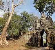
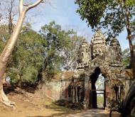
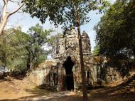
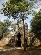
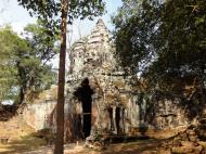
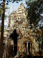
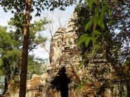
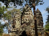
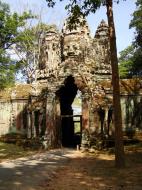
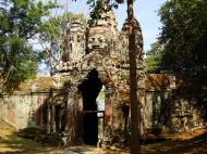
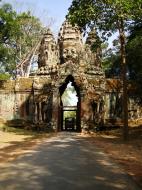
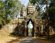
Angkor North Gate
Angkor Thom was the last and most enduring capital city of the Khmer empire.
It covers an area of 9 km�, within which are located several monuments from earlier eras as well as those established by Jayavarman and his successors.
At the centre of the city is Jayavarman's state temple, the Bayon, with the other major sites clustered around the Victory Square immediately to the north.
Angkor Thom was established as the capital of Jayavarman VII's empire, and was the centre of his massive building programme.
One inscription found in the city refers to Jayavarman as the groom and the city as his bride. Yasodharapura, dating from three centuries earlier, was centred slightly further northwest, and Angkor Thom overlapped parts of it. The most notable earlier temples within the city are the former state temple of Baphuon, and Phimeanakas, which was incorporated into the Royal Palace. The name of Angkor Thom 'great city' was in use from the 16th century.
Thereafter the existing structures continued to be modified from time to time, but any new creations were in perishable materials and have not survived.
In the following centuries Angkor Thom remained the capital of a kingdom in decline until it was abandoned some time prior to 1609, when an early western visitor wrote of an uninhabited city, 'as fantastic as the Atlantis of Plato' which some thought to have been built by the Roman emperor Trajan.
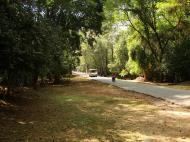
The city lies on the right bank of the Siem Reap River, a tributary of Tonle Sap, about a quarter of a mile from the river. The south gate of Angkor Thom is 7.2 km north of Siem Reap, and 1.7 km north of the entrance to Angkor Wat. The walls, 8 m high and flanked by a moat, are each 3 km long, enclosing an area of 9 km�. The walls are of laterite buttressed by earth, with a parapet on the top.
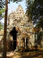
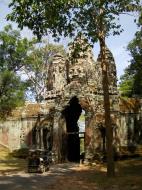
There are gates at each of the cardinal points, from which roads lead to the Bayon at the centre of the city. As the Bayon itself has no wall or moat of its own, those of the city are interpreted by archaeologists as representing the mountains and oceans surrounding the Bayon's Mount Meru. Another gate the Victory Gate is 500 m north of the east gate; the Victory Way runs parallel to the east road to the Victory Square and the Royal Palace north of the Bayon. The faces on the 23 m towers at the city gates (which are later additions to the main structure) take after those of the Bayon, and pose the same problems of interpretation. A causeway spans the moat in front of each tower: these have a row of devas on the left and asuras on the right, each row holding a naga in the attitude of a tug-of-war.
The temple-mountain of the Bayon, or perhaps the gate itself, would then be the pivot around which the churning takes place.
The nagas may also represent the transition from the world of men to the world of the gods (the Bayon), or be guardian figures.
The south gate is now by far the most often visited, as it is the main entrance to the city for tourists.
At each corner of the city is a Prasat Chrung corner shrine built of sandstone and dedicated to Avalokiteshvara.
The bulk of the land enclosed by the walls would have been occupied by the secular buildings of the city, of which nothing remains. Most of the great Angkor ruins have vast displays of bas-relief depicting the various gods, goddesses, and other-worldly beings from the mythological stories and epic poems of ancient Hinduism (modified by centuries of Buddhism). There are no mythological figures among the roundels, so one can reasonably conclude that these figures depict the animals that were commonly seen by the ancient Khmer people in the twelfth century.
Angkor's North Gate Siem Reap, Cambodia Map
 Editor for Asisbiz: Matthew Laird Acred
If you love our website please add a like on facebook
Please donate so we can make this site even better !!