 |
 |
 |
 |
 |
 |
 |
 |
 |
 |
 |
 |
 |
 |
 |
 |
 |
 |
 |
 |
 |
 |
 |
 |
 |
 |
 |
 |
 |
 |
 |
 |
 |
 |
 |
 |
 |
 |
 |
 |
 |
 |
 |
 |
 |
 |
 |
 |
 |
 |
 |
 |
 |
 |
 |
 |
 |
 |
 |
 |
 |
 |
 |
 |
 |
 |
 |
 |
 |
 |
 |
 |
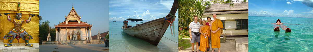
Southern Thailand
Wat Phra Mahathat Woramahawihan
วัดพระมหาธาตุวรมหาวิหาร จังหวัดนครศรีธรรมราชDescription: Wat Phra Mahathat Woramahaviharn AKA: Wat Baromathat, Nakhon Srithammarat is one of the important historical place of Southern Thailand, more than 1,500 years old in Srivichai period.
The Jedis of Wat Phra Baromathat were inspired by the Pagoda of Srilanka and become the sign of Nakhon Srithammarat Town, also appeared on back side of Archan Chum and Khun Pund's amulet made in year B.E.2497.Nakhon Si Thammarat (Thai: นครศรีธรรมราช)
Nakhon Si Thammarat (Thai: นครศรีธรรมราช) (alternative English transliteration: Nakhon Sri Thammarat from Pali Nagara Sri Dhammaraja) is a town in southern Thailand, capital of the Nakhon Si Thammarat Province and the Nakhon Si Thammarat district. It is about 610 km (380 miles) south of Bangkok, on the east coast of the Malay Peninsula. The city was the administrative center of southern Thailand during most of its history. Originally a coastal city, silting moved the coastline away from the city. The city has a much larger north to south extension than west to east, which dates back to its original location on a flood-save dune. The modern city centre around the train station is located north of Old Town.
It is one of the most ancient cities of Thailand, previously Kingdom of Ligor, and contains many buildings and ruins of historical significance. With the fall of the Siamese capital of Ayutthaya in 1767 it regained independence, but returned to its allegiance on the founding of Bangkok. In the 17th century British, Portuguese and Dutch merchants set up factories there and carried on an extensive trade.
The current name comes from the Sanskrit, Sri Dharma Raja.
As of 2005, the city has a population of 105,417.
History
The city of Nakhon Si Thammarat is one of the oldest towns of southern Thailand. Its origins are not fully known. Most historians recognize the Tambralinga kingdom of Chinese records as a precursor of Nakhon Si Thammarat. The town chronicles of this time are hardly separable from legend, but they do tell of an abandonment and refounding of the town, which would explain the break in history between Tambralinga and Nakhon Si Thammarat.
References to a country named Poling appear in Chinese chronicles from the Tang dynasty period down to the early Ming dynasty. Many scholars identify Poling with Maling and Danmaling was one of the member-states of Sanfoqi (mean Srivijaya in Chinese language) in the central part of the Malayu Peninsula or now a day the southern Thailand. Consequently, Poling may also be equated to the Tambralingarat (Tambralinga state) that appear in Indian sources. By the end of the 12th century, Tambralinga had become independent of Srivijaya kingdom. Its rapid rise to prominence since the 13th century till the beginning of 14th century, Tambralinga had occupied the entire Malay Peninsula and become one of the dominant Southeast Asian states. By the end of the 14th century, Tambralinga had become a part of Siam (now Thailand) named Nakhon Si Thammaraj.
At the time of the Sukhothai kingdom, the Nakhon Si Thammarat kingdom was already listed as one of the kingdoms under control of the Thai, which it has remained during most of its history. It was usually known as Ligor to European merchants in the 16th century. At the end of the 19th century, the kingdom was finally fully absorbed into Siam by converting it into the Monthon Nakhon Si Thammarat. With the abolishment of the monthon system in 1932, the town now is simply a provincial capital.
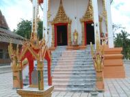
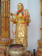
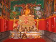
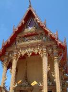
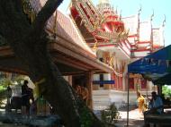
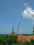
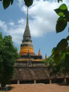
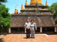
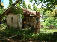
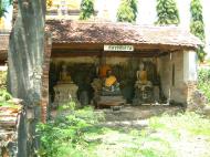
Wat Phra Mahathat Woromaha Vihan
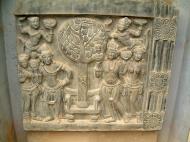
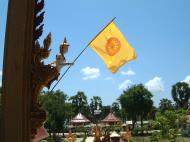
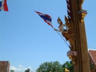
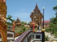
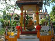
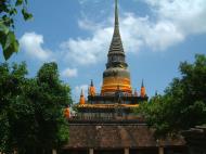
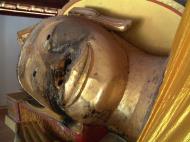
Chedi Phra BaromathatWat Phra Mahathat (Thai วัดพระมหาธาตุวรมหาวิหาร) is the most important temple of Nakhon Si Thammarat and southern Thailand. It was constructed at the time of the founding of the town, and contains a tooth relic of Buddha. The 78 m high chedi is surrounded by 173 smaller ones. While the chedi is now in Sri Lankan style, it is said to be built on top of an earlier Srivijaya style chedi.
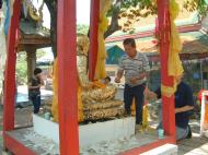
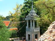
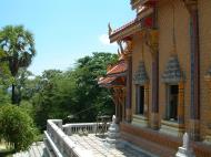
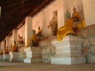
At the base of the chedi is a gallery named Viharn Tap Kaset, decorated with many Buddha statues and elephant heads emerging from the chedi. Viharn Phra Song Ma is the buildings which contains the staircase which leads to a walkway around the chedi above the gallery. At the bottom of the staircase are demon giants (yak) as guardians. Adjoining to the north is the Viharn Kien, which contains a small temple museum.
South of the chedi is the large ubosot building, the Viharn Luang. The monk living quarters are located across the street in a separate temple, Wat Na Phra Boromathat.
The chedi is the symbol of the Nakhon Si Thammarat province, present in the seal of the province. It is also displayed on the 25 satang coin.
Northern Gate
The city chronicle already mentions a fortification when the town was refounded in 1278. Restorations were recorded at the time of King Ramesuan (14th century), as well as King Narai (1686). The latter one was supported by the French engineer M. de la Mare.
The walls spread 456 m from East to West, and 2238 m North to South, thus enclosing an area of about one square kilometre. The northern wall had only one gate, called Prathu Chai Nua or Prathu Chai Sak, also the southern wall had only one gate. To the east there were three gates, which connected the town with the sea. To the west were five gates. Today only the northern gate still exists, together with a short stretch of the northern city wall.
Ratchadamnoen street, Nakhon Si Thammarat DowntownEducational institutions
Nakhon Si Thammarat is has three large secondary schools, Kanlayanee Si Thammarat School, Benjamarachutit School and Srithammarat Suksa School.Museums
* Nakhon Si Thammarat National MuseumReferences Stuart Munro-Hay. Nakhon Sri Thammarat - The Archaeology, History and Legends of a Southern Thai Town. ISBN 974-7534-73-8
洛坤府的全称其实是那空是塔玛叻府,(Nakhon Si Thammarat),是泰国南部人口最多的府。东面临着泰国湾,邻近府份从南到北按顺时针顺序为:宋卡府、博他仑府、董里府、甲米府和素叻府。本府名字 在印度梵文中意思是“圣王之城”(“City of the Sacred Dharma King/Nagara Sri Dhammaraja”)。
地理环境:本府位于马来半岛上,东滂泰国湾,地形多山,包括整个南泰国最高峰黄山(Khao Luang),今天的黄山国家公园(Khao Luang National Park)是自然保护区。
(注:洛坤府的黄山比中国黄山主峰莲花峰仅低65米。)
历史渊源:洛坤府历史极其悠久,公元3世纪即有斯威再也王国(Srivijaya Kingdom)在此建国。后来经历了泰国各个朝代更替,素可泰王国、阿育跎耶王国、却克里王国。 五世泰王朱拉隆功大帝曾设立洛坤道(Monthon Nakhon Si Thammarat),晋洛坤府城为道都。一直到1931年泰国“化道为府”,南方其他府份始从她的版图中分离自立。 府徽与府花:府徽上显示一座佛塔,这座塔的名称为Baromathat佛塔 (Phra Baromathat Chedi),位置于本府历史名寺Wat Phra Mahathat Voramahavihan之中。 洛坤府著名Phra Baromathat Chedi佛塔府花为:Golden Shower Flower(学名为:Cassia fistula)。 行政与管理:本府行政上被划分为21个县(ampoe),2个次县(king ampoe),又进一步被划分为165个区(tambon)及1428个村(muban)。Web References: http://en.wikipedia.org/wiki/Nakhon_Si_Thammarat
Southern Thailand, Thailand Map
 Editor for Asisbiz: Matthew Laird Acred
If you love our website Please donate so we can make this site even better !!
Please donate so we can make this site even better !!