
 |
 |
 |
 |
 |
 |
 |
 |
 |
 |
 |
 |
 |
 |
 |
 |
 |
 |
 |
 |
 |
 |
 |
 |
 |
 |
 |
 |
 |
 |
 |
 |
 |
 |
 |
 |
 |
 |
 |
 |
 |
 |
 |
 |
 |
 |
 |
 |
 |
 |
 |
 |
 |
 |
 |
 |
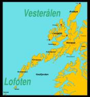
Lofoten Archipelago
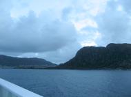
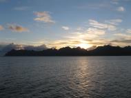
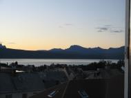
Lofoten is an archipelago and a traditional district in the county of Nordland, Norway. Though lying within the Arctic Circle, the archipelago experiences one of the world's largest elevated temperature anomalies relative to its high latitude.
Etymology
Lofoten (Norse Lófót) was originally the old name of the island Vestvågøya. The first element is ló 'lynx', the last element is fót 'foot'. The shape of the island must have been compared with a foot of a lynx. (The old name of the neighbouring island Flakstadøya was Vargfót 'the foot of a wolf' - from vargr m 'wolf'.)Geography and nature
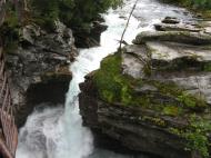
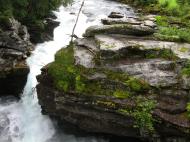
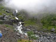
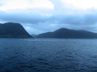
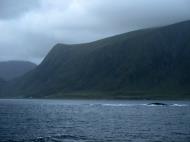
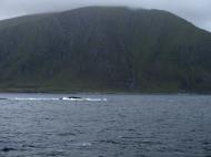
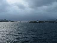
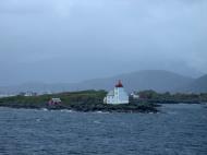
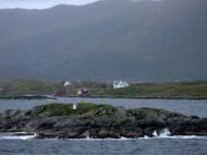
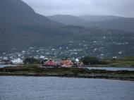
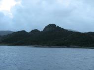
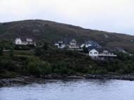
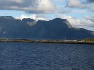
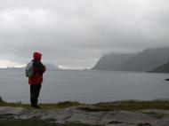
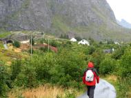
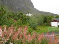
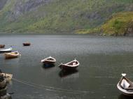
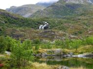
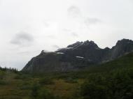
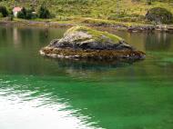
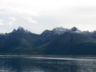
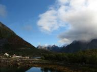
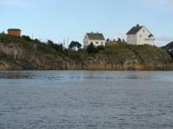
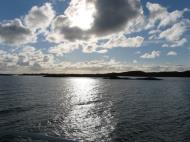
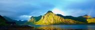
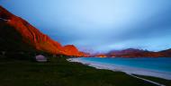
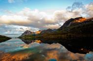
Lofoten is located at the 67th and 68th parallels north of the Arctic Circle in North Norway. It is well known for its exceptional natural beauty within Norway. Lofoten encompasses the municipalities of Vågan, Vestvågøy, Flakstad, Moskenes, Værøy and Røst. The principal islands, running from north to south, are: Southern tip of Hinnøya; South of Austvågøy; Gimsøy; Vestvågøy; Flakstadøya; Moskenesøya, whilst further to the south are the small and isolated islands of Værøy and Røst. The total land area amounts to 1,227 km², and the population totals 24,500.Many will argue that Hinnøya, the northern part of Austvågøy and several hundred smaller islands, skerries and rocks to the east of Austvågøy are also part of the Lofoten complex. Historically the territorial definition of Lofoten has changed significantly. Between the mainland and the Lofoten archipelago lies the vast, open Vestfjord, and to the north is Vesterålen. The principal towns in Lofoten are Leknes in Vestvågøy and Svolvær in Vågan. The Lofoten Islands are characterised by their mountains and peaks, sheltered inlets, stretches of seashore and large virgin areas. The highest mountain in Lofoten is Higravstinden (1,161 m / 3,800 ft) in Austvågøy; the Møysalen National Park just northeast of Lofoten has mountains reaching 1,262 m. The famous Moskstraumen (Malstrøm) system of tidal eddies is located in western Lofoten, and is indeed the root of the term maelstrom. The sea is rich with life, and the world's largest deep water coral reef is located west of Røst. Lofoten has a very high density of sea eagles and cormorants, and millions of other sea birds, among them the colourful puffin. Otters are common, and there are moose on the largest islands. There are some woodland with Downy birch and Rowan. There are no native conifer forest in Lofoten, but some small areas with private spruce plantations. Sorbus hybrida (‘Rowan whitebeam’) and Malus sylvestris occur in Lofoten, but not further north.
Climate
Winter temperatures in Lofoten are very mild considering their location north of the Arctic Circle; this is the largest positive temperature anomaly in the world relative to latitude. This is due to the Gulf Stream and its extensions: the North Atlantic Current and the Norwegian Current. Røst and Værøy are the most northerly locations in the world where average temperatures are above freezing all year. Winters are slightly colder in the northeastern part of Lofoten; Svolvær has a January average of -1.5°C (30°F), but summers are a bit warmer, with both July and August 24-hr averages of 13°C (56°F). May and June are the driest months, while October has three times as much precipitation. Typical daytime temperature in May is 9°C (48°F), in July 15°C (60°F) and in September 11°C (52°F). The warmest recording in Svolvær is 30.4°C (87°F). Strong winds can occur in late autumn and winter, but are rare late March - mid-October. Snow and sleet are not uncommon in winter; the mountains can have substantial amounts of snow. Two of the top ten deadliest rainstorms ever recorded passed through Lofoten.In Svolvær, the sun (midnight sun) is above the horizon from May 25 to July 17, and in winter the sun does not rise from December 4 to January 7. In Leknes, the sun is above the horizon from May 26 to July 17, and in winter the sun does not rise from December 9 to January 4.
The temperature in the sea has been recorded since 1935. At 1 m depth in the sea near Skrova, water temperatures varies from a low of 3°C in March to 14°C in August; some years peaking above 17°C; November is around 7-8°C. At a depth of 200 m the temperature is near 8°C all year.
History
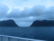
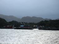
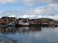
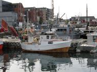
Vågar is the first known town formation in northern Norway. It existed in the early Viking Age, maybe earlier, and was located on the southern coast on eastern Lofoten, near today's village Kabelvåg in Vågan municipality. However, the Lofotr museum with the reconstructed 83 m long longhouse (the largest known) is located near Borg on Vestvågøy, which have many archeological finds from the Iron Age and Viking Age. The islands have for more than 1,000 years been the center of great cod fisheries, especially in winter, when the cod migrates south from the Barents Sea and gathers in Lofoten to spawn. Bergen in southwestern Norway was for a long time the hub for further export south to large parts of Europe, particularly so when trade was controlled by the Hanseatic League. In the lowland areas, particularly Vestvågøy, agriculture plays a significant role, as it has done since the Bronze Age.Lofotr was originally the name of the island of Vestvågøy only. It has later become the name of the chain of islands. The chain of islands with its pointed peaks looks like a lynx' foot from the mainland. In Norwegian, it is always a singular. Another name one might come across, is ‘Lofotveggen’ - or the Lofoten wall. The archipelago looks like a closed wall when seen from elevated points around Bodø or when arriving from the sea, some 100 km. long, and 800-1,000 m. high.
During 1941, the islands were raided by British Combined Operations commandos during Operation Claymore in March and a subsequent diversionary attack to support the Vaagso raid in December.
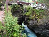
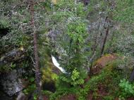
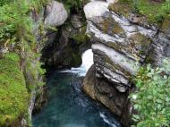
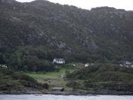
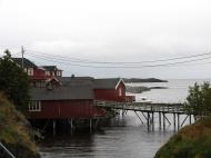
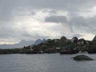
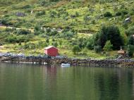
Nusfjord
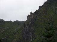
Lofoten offers unique rock climbing and mountaineering opportunities. It has 24 hours of daylight in the summer and has Alpine-style ridges, summits and glaciers, but at a height of less than 1,200 metres. The main centre for rock climbing is Henningsvær on Austvågøya.The main areas for mountaineering are on Austvågøya and Moskenesøya. For more information, see the books by Dyer and Webster (see references).
Cycling
There is a well marked cycling route that goes from Å in the south and continues past Fiskebøl in the north. The route is part public road, part cycle-path with the option to bypass all of the tunnels by either cycle-path (tunnels through mountains) or boat. Traffic is generally light, although in July there may be a lot of camper vans. Some of the more remote sections are on gravel roads. There is a dedicated cycling ferry which sails between Ballstad and Nusfjord, allowing cyclists to avoid the long, steep Nappstraum tunnel. The route hugs the coastline for most of its length where it is generally flat. As it turns inland through the mountain passes there are a couple of 3-400 meter climbs.The Lofoten Insomnia Cycling Race takes place every year around midsummer, possible in the midnight sun, but surely in 24-hr daylight, along the whole Lofoten archipelago.
Communications
Lofoten is served by three small airports: Leknes Airport (84 215 passengers in 2006), Svolvær Airport, Helle (63 787 passengers in 2006), and Røst Airport (7 755 passengers in 2006), which mainly offers flights to Bodø. There is a heliport at Værøy (7 923 passengers in 2006). Stokmarknes Airport, Skagen is located in Vesterålen. Harstad/Narvik Airport, Evenes has direct flights to Oslo and Trondheim. Bodø is often used as a hub for travel to Lofoten; in addition to air travel there is a ferry connecting Bodø to Moskenes. There is also a ferry connecting Svolvær to Skutvik in Hamarøy, with road connection east to E6. Hurtigruten calls at Stamsund and Svolvær.The European road E10 connects the larger islands of Lofoten with bridges and undersea tunnels. The E10 road also connects Lofoten to the mainland of Norway through the Lofast road connection, which was officially opened on December 1 2007. There are several daily bus services between the islands of Lofoten and between Lofoten and the mainland along E10.
http://en.wikipedia.org/wiki/Lofoten
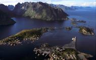
http://en.wikipedia.org/wiki/File:Reine-3.jpgNordland
Nordland Coat of Arms
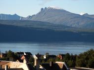
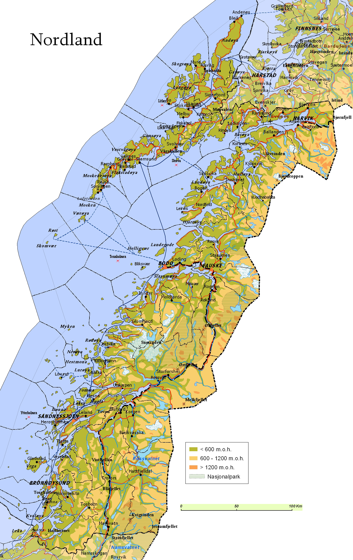
Nordland is a county in Norway, bordering Troms in the north, Nord-Trøndelag in the south, Norrbottens län in Sweden to the east, Västerbottens län to the southeast, and the Atlantic Ocean (Norwegian Sea) to the west. The county was formerly known as Nordlandene amt. The county administration is in Bodø. The remote Arctic island of Jan Mayen has been administered from Nordland since 1995. In the southern part is Vega, listed on the Unesco World Heritage list. The history of Nordland is a tale about the gifts from the sea: One of the most productive seas in the world providing food all year since ancient times, the same sea creates a climate more moderate than any other place in the arctic; even the bedrock itself enriched by sea living organisms millions of years ago in the geological past.
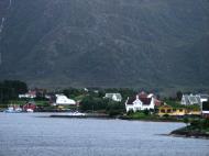
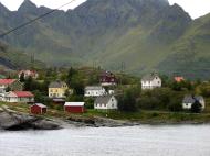
Reine in LofotenDistricts
The county is divided into traditional districts. These are Helgeland in the south (south of the Arctic Circle), Salten in the center, and Ofoten in the northeast. In the northwest lie the archipelagoes of Lofoten and Vesterålen.
Geography
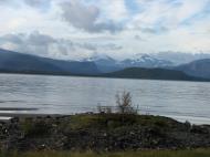
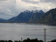
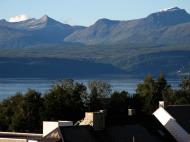
Nordland is located along the northwestern coast of the Scandinavian peninsula in North Norway. Due to the large distance to the densely populated parts of Europe, this is one of the least polluted areas in Europe. Nordland extends about 500 km from Nord-Trøndelag to Troms. The distance by road from Bindal in the far south of the county to Andenes on the northern tip is roughly 800 km. Nordland has a rugged coastline, with many fjords. From south to north, the main fjords are Bindalsfjord, Vefsnfjord, Ranfjord, Saltfjord-Skjerstadfjord, Folda, Tysfjord, Ofotfjord (the longest) and Andfjord, which is shared with Troms county. The best-known is perhaps Vestfjord, which is not really a fjord, but an open stretch of sea between the Lofoten island group and the mainland. The Raftsundet strait, with its famous branch Trollfjord, is the shortest waterway connecting Lofoten and Vesterålen. The continental shelf is very narrow west of Andenes, nowhere else in Norway is the deep ocean only a few miles from shore. Saltstraumen whirlpool is just southeast of Bodø, and Moskstraumen is located in southern Lofoten.
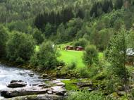
Steep mountains near the sea and an almost flat lowland area in between the mountains and the sea (Strandflaten, coastal brim) is very typical for the long coastline in Nordland, and Strandflaten often continues out from the shore, the result is numerous islands (skerries), of which Helgeland have thousands; these islands are usually mountainous, but with smaller or larger strandflate areas. The southern part of Norways largest island (apart from Svalbard), Hinnøya is in Nordland, as is the third largest island, Langøya. In the fjords, the coastal brim is much less developed: There might be a more gradual slope, with hills, towards the mountains, or no lowland at all. There are often valleys at the head of fjords (the fjord is an extension of the valley), usually with a river at the centre of the valley. Mo i Rana, Mosjøen and Rognan are situated in such valleys.
Norway's second largest glacier, Svartisen, the second largest lake, Røssvatnet, and the second deepest fjord, Tysfjord (897 m) are all located in Nordland. The largest river (waterflow) is Vefsna which forms the Laksforsen waterfall.
The largest rivers follows the longest inland valleys. Ranelva at the meeting point with Langvassåga, Rana.
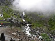
The Saltfjellet mountain range forms a natural border between Helgeland and Salten, and is where the Arctic circle cuts through the county. The western part of this mountain range is dominated by steep mountains and fjord inlets, with glaciers stretching towards the sea, while the eastern part of the mountains is more gentle and rounded, with some forested valleys, and is well suited for hiking. The interior of Nordland, towards the border with Sweden, is dominated by the Kjølen Mountains (Scandinavian Mountains). The highest mountain in Nordland is Oksskolten (1,915 m /6,300 ft) in Okstindan range, the second highest is Suliskongen (1,907 m) in Fauske, and the third is Storsteinfjellet (1,894 m) in Narvik. Stetind in Tysfjord has been elected to be Norway's national mountain.
There are many glaciers in the mountains, like Blåmannsisen, Okstindbreen, Sulitjelmaisen and Frostisen - 7 of the 15 largest glaciers in continental Norway are located in Nordland.
Limestone is very common in Nordland, and there are thus many caves throughout the county, the most famous being Grønligrotta in Rana, the only in Norway with electrical lights installed. There are more caves in Rana than any other area in northern Europe. In August 2006 the Tjoarvekrajgge cave in Sørfold was explored and verifed as the longest cave in Scandinavia, at least 22 km long. There are more than 900 caves in Nordland, one of these have a 70 m high waterfall (DN.no). Marble is found in several locations. Fauske is sometimes referred to as the marble capital, and has exported marble world wide (one customer being the UN building in New York City). Part of the mountains in the Lofoten is amongst the world's oldest, at least 3 billion years old. The youngest rock in Norway is on Andøya, also known for its fossils of dinosaurs and other life forms.
Climate
Most areas except the outer seaboard have at least 4 months with snow cover, with 6 months at higher elevations near the treeline, such as here in Jakobsbakken near Sulitjelma. Photo: Lars Røed HansenNordland has a very mild climate for the high latitude. Some islands, like Myken, Træna and Røst, have average temperatures of ca 1°C (33°F) in their coldest month, 25°C (45°F) above average for the latitude. Nordland covers almost 5° latitude, but temperatures are moderated by proximity to the temperate sea; the annual mean only varies from 5.6°C (42°F) on the southern coast to 4°C (39°F) on the northern coast. Summers are somewhat longer in the south. Winters are colder in the interior, fjords will moderate temperatures in nearby areas. Mountain areas are colder all year, with much longer winters - snow cover can persist all year at the higher mountains. While snow cover usually is modest in coastal areas due to thaws with rain, yearly snow accumulation can exceed 5 m in the mountains - the main reason for the many glaciers in Nordland. Easterly winds give dry, sunny weather (the air must climb the Kjølen mountains), with warmth in summer and cold, clear air in winter. The warmest night ever in Norway, with a minimum temperature of 25.8°C, was recorded in Alstahaug 5 July 1937 (foehn winds coming over the mountains and 24-hr sunlight). Southwesterly winds are common, bringing moist and mild air from the Atlantic ocean. Autumn is the wettest season along the coast of Nordland, and April - June is the driest. The strongest winds occur in winter, when powerful low pressure systems arrive from the Atlantic - but high pressure weather can occur in all seasons.
Brønnøysund on the Helgeland coast has about 2.5 months of the year with 24-hr average below freezing (-1°C (31°F) in January), while summer (24-hr average at least 10°C) last 3.5 months, with 24-hr average 13°C (56°F) in July. Mean annual is 5.6°C (42°F, as in Oslo), precipitation is 1510 mm. Inland valleys away from fjords, although not far from the coast, are considerably colder in winter; Hattfjelldal at 380 m above sea level has January average -9°C (16°F) - but summer days are usually at least as warm as in coastal areas.
The Arctic Circle cuts through Nordland, defining light conditions - but not necessarily climate.
April in Hamarøy, view from E6. Sheltered by Lofoten, Hamarøy has the county heat record with 33.1°C recorded 3 July 1972.Saltdal (81 m, Salt Valley) northeast of Svartisen, is one of the driest valleys in Norway with mean annual precipitation only 291 mm ; it is also well known for warm summer days compared to coastal areas, there are some days every year that Saltdal records the highest temperature in Norway. Lurøy (115 m), west of Saltfjell, averages 2,935 mm precipitation annually; the wettest location in North Norway and in the world at such high latitude. Some of the wettest areas along the coast (a narrow band) north to Glomfjord fulfills the climatic criteria for a temperate rainforest. Eastern Saltfjell, at an elevation of 680 m (2100 ft, the E6's highest elevation), located just above the treeline has an alpine tundra climate with January average of -11°C (12°F) and July average 9.7°C (50°F). Temperatures will generally drop 0.7°C (1°F) as elevation increases by 100 m. With mountains everywhere, alpine tundra is very common in Nordland.
Recent years have tended to be warmer (annual temperature Nordland-Troms since 1900); January average in Bodø (11 m) based on the 17-year period 1991 - 2007 is -0.3°C (from -2.2°C 1961 - 1990), with average daily high temperature of 2.0°C (35°F). July average for the same 17 years is 13.5°C (up from 12.5°C), with average daily high 16.6°C (62°F).
Research using sediment in lakes near the Okstind Glacier has shown that the summer climate in Nordland was up to 2.5°C warmer 9,000 to 6,000 years ago, and then slowly cooled - it was 0.5°C warmer 2,000 years before present (see Holocene climatic optimum.). This research also concluded that the eastern Okstind Glacier did not melt completely during this warm period, the first glacier in Norway known to have survived since the Ice age (Bjerknes climate research centre - Norwegian).
Climate statistics provided by Norwegian Meteorological Institute; 1961–1990 base period unless otherwise stated. Data for 1991–2007 from the official database eklima at met.no.
Light
The light conditions varies considerably from north to south; Andenes in the north will have midnight sun from 22 May to 20 July, and the sun is below the horizon from 28 November to 16 January (Narvik daylight). In Bodø, the sun is above the horizon from 3 June to 8 July. Helgeland is situated south of the Arctic Circle: At winter solstice the sun is above the horizon approximately 3 hours a day (Mosjøen daylight). There is not a true midnight sun in Helgeland, although the upper part of the sun disc will be above the horizon all night in June as far south as Mosjøen. With the transitional period with a short dusk included, there are three full months (from early May to early August) without darkness in Nordland.Nature
Røst has the largest sea bird colonies along the Norwegian coast.The sea along the coast has a rich marine life, and the cod fisheries in Lofoten has lasted for more than 1000 years. In addition to cod, coalfish, haddock, herring, wolf fish and halibut are all common along the coast and in the fjords. The largest deep water coral reef (Lophelia pertusa) in the world, the Røst reef, 40 km long, is located west of Røst, and protected from trawling since 2003 (imr.no). The coast of Nordland has the highest density of sea eagles in Europe. There are millions of seabirds; the islands of Røst has the largest colonies in Norway with about one-quarter of all seabirds in continental Norway, probably most famous for the Puffins and Cormorants. Lovund also has a well-known colony of Puffins. Otters are very common along the coast and fjords, as is Harbour porpoise, harbor seals; there are also seals. The character birds along the coast, common in all areas including the fjords, are sea gulls, Eurasian Oystercatcher and Arctic terns, and the Grey heron has also become common. The Eagle-owl has a stronghold along the Helgeland coast; predator birds like Golden eagle, Gyrfalcon and Peregrine falcon nest in some inaccessible areas. Orcas are common along the coast and in the Vestfjord-area (even in the fjords) in winter, and the worlds largest predator, the Sperm Whale, hunt for prey in the deep waters west of Andøya. Spruce forest expansion have been blocked by Saltfjell and Kjølen mountains, thus spruce forest naturally grows only in Helgeland, but are commonly planted in the whole county for economic reasons, sparking some debate. Sitka spruce is also commonly planted in Nordland, particularly in coastal areas. Part of the native spruce forest in the south belongs to the Scandinavian coastal conifer forests. Inland valleys and most fjord areas below the conifer treeline belong to the Scandinavian and Russian taiga ecoregion, while the highlands and mountains belong to the Scandinavian montane birch forest and grasslands ecoregion.
Junkerdal Nature Reserve, which borders Junkerdal National Park, Saltdal, is known for its diverse flora. A well marked path makes this sheltered valley easily accessible from the E6 road.Other common trees in Nordland are birch, rowan, willow, grey alder, bird cherry, aspen and Scots pine, more rarely seen is wych elm and common hazel (elm north to Beiarn, hazel north to Steigen, small-leaved lime north to Brønnøy, forest apple north to Moskenes). The Nordland Whitebeam (Nordlandsasal) is one of very few endemic trees in Norway, and only grows in Bindal in Nordland.
In the mountain areas in the interior, reindeer can be seen (these have sami owners), hunted by the indigenous wolverine. There are also a few brown bears in the interior. The arctic fox is now in danger of extinction on the mainland, but a few are left in these mountain areas, particularly in Børgefjell mountains. Red foxes, moose, hares, squirrels, small rodents, pine marten (inland valleys) and stoats are all common in the forests. As of 2008, there were a minimum of 50 Lynx in Nordland (nordland miljøstatus), residing in the forests in all Nordland except Lofoten and Vesterålen. In lowland areas, roe deers now occur in most of Nordland, and red deers are seen in the southern part of Nordland. The Badger and the Common viper has their most northerly habitat in southerly coastal areas of Nordland. Gray wolfs have been observed in inland areas of Helgeland.
Economy
The key industries are fisheries and offshore petroleum exploration. Nordland is well known for the fishing of codfish and fish farming of salmon. Main export markets are Germany, Scandinavia, Britain, Netherlands, Italy, Spain, France, Russia and Japan.Tourism is important, mainly in the summer season, although there are some winter visitors looking for good skiing, especially from February to April. Tourists are attracted by the scenic coast, especially Lofoten, which is also visited by many cruise ships in the summer, while the rest of the county often is ignored by tourists. Mountain hiking is popular among natives and some tourists.
Whale watching attracts tourists to Andøy and the Tysfjord /Lødingen /Svolvær area, and fishing is also popular along the coast and in the salmon and trout rivers; there is also Arctic char in some rivers. Saltstraumen has the world record for coalfish using a fishing rod, and Røst has the world record for halibut, 202 kg.
Tourism has increased somewhat at the Vega Archipelago following the listing as a Unesco World Heritage Site.
Farming is another regional economy, and comprise mainly of dairy farming and livestock such as sheep, and domesticated reindeer graze the inland highlands. There is also some forestry, particularly in the Helgeland district, but also further north. In earlier days, grain was grown in Nordland (mostly barley, some oats). Nordlandshest is the smallest of the three Norwegian horse breeds. Norwegian Lundehund was breed to hunt puffins and only saved from extinction due to a few remaining dogs in Lofoten.
There is a long history of mining. Sulitjelma has the largest copper deposits in the county, as well as pyrite, the latter is also found in several other locations, but the mining here has been discontinued for economical reasons. In earlier days, silver was mined in Dunderlandsdal in Rana, and until 2002 nickel and olivine was mined in Ballangen. There are several limestone, marble, and dolostone quarries, dolomite in Vefsn, Fauske, Sørfold and Ballangen. As of 2008, mining of gold in Bindal is in testing stages. The port of Narvik has a direct rail connection to the well known and profitable Kiruna-Gällivare iron-ore fields in Sweden. There are many dams for hydroelectric power. Nordland has an increasing diverse economy, with fledgling research and development in aerospace and space exploration at the Andøya Rocket Range, which primarily is known for its satellite launches. This vast province, Norway's second largest, almost the size of Denmark, traditionally was very important for NATO, and the Royal Norwegian Air Force has two squadrons of F-16 fighters stationed at Bodø Airport, and all its P-3 Orion maritime surveillance aircraft stationed at Andøya Air Station. The decommissioning of closing military bases has led to a regional shift towards a new knowledge based economy.
Bodø Airport is a hub for the many smaller airports in Nordland. Harstad/Narvik Airport, Evenes in the north also has non-stop flights to Oslo. The E6 runs along the entire length of Nordland. There are many tunnels and bridges; some of the largest are Helgeland Bridge, Gimsøy Bridge, Raftsund Bridge, Skjomen Bridge, Rombak Bridge, Hadsel Bridge, Sortland Bridge, Andøy Bridge, Saltstraumen Bridge, Kjellingstraumen Bridge and Brønnøysund Bridge. Even with improved communications, population numbers in Nordland has actually decreased slightly since 1990, as many young people move to larger cities in Norway. Bodø is the only municipality in the county with a significant growth in population.
History
There is evidence of human settlement in Nordland as far back as 10,500 years ago, about as early as in southern Norway. These Stone age people lived near the coast, often on islands and typically along straits near the open sea, with a rich provision of marine resources. Such archeological evidence has been found on Vega, in Leirfjord and along Saltstraumen. There are at least 15 locations with prehistoric rock carvings in Nordland, from Helgeland in the south to Narvik in the north (see Fosna-Hensbacka culture).Some of the oldest houses known in Norway was excavated on Langhågan on the island Sanna in Træna municipality; the oldest house was oval, 6 x 4.5 m, and is dated to 4000 BC. From the house is still visible a 65 m long stone paved 'trail' down to a small harbor (No: Båtstø), today 23 m above sea level.
The 4,600 year old rock drawings at Rødøy, which depict a man on skis holding a stick, is the oldest known reference of skis being used. The location is somewhat surprising, as this island has unreliable snow cover, and the Scandinavian climate was warmer in the Stone Age.
This rock drawing was used as a pictogram in the Lillehammer Olympic Games in 1994.
The first agricultural culture has been dated to the Bronze Age. This culture left large burial cairns close to the sea, for instance in Steigen and Vestvågøy, and the northernmost location is around Harstad in southern Troms. These locations have significant areas of lowland suited for agriculture, they are close to the sea and they have many natural harbors.
The oldest remains of a boat ever found in Norway was discovered in a bog in Sømna. Known as Haugvikbåten, the well preserved piece, kept in the Museum of Science (Vitenskapsmuseet) in Trondheim, has been dated to 800 - 400 BC - the Nordic Bronze Age.
The marble phallus on Dønna.For many generations Hålogaland had been the northernmost area of Norse settlement. The remnants of large longhouses near Borg (Vestvågøy) and in Steigen is dated to the Merovinger period (ca 600 AD). There are substantial archeological evidence of a Norse iron-based culture along the coast from approximately 200 AD.
Nordland is regarded as part of Sapmi. The Sami, which are not of Norse origins, have lived in Nordland for at least 2000 years. Not just inland, but also along the fjords and, in the northern part of Nordland, even on the coast and larger islands, such as Hinnøya. There is a story in Heimskringla about a Viking which became a contender for the throne, Sigurd Slembe. He was on the run from the king, and was helped by Sami in what is probably Lødingen municipality today. The sami even built him a boat, which the saga mention was made from pine wood (viking ships was typically made from oak wood, but oak does not grow naturally this far north). Tysfjord today is a center for the Lule Sami culture.
The current county of Nordland was part of the petty kingdom of Hålogaland in the Viking era. This kingdom also included southern part of Troms.
In January 1432, an Italian trade ship going from Crete to Flandern was hit by a storm and taken far north where it was wrecked; some of the crew survived and came ashore on a small island near Røst. They were taken care of by the people of Røst. The story, told by one of the men, Pietro Querini, gives one of very few descriptions of life in Nordland in this time period (Querini - Norw txt). Querini sees the people of Røst (in all 120 people) as very trusting and good Catholics, the inner circle of paradise. He also mentions a German priest, which they could talk to in Latin. People lived from fishing cod and halibut, which they traded for other goods (like grain) in Bergen - the cod as stockfish. Each family also had about 5 cows, and collected eggs from semi-domesticated ducks. The shipwrecked men did not lack food during their winter stay, usually fish, but Querini also mention, milk, meat, butter and pancakes. The people of Røst lived in round, wooden houses, and mostly used clothes made by wool. By late May, sailing in 24-hr daylight, the Italians were taken south to Bergen.
The Battle of Narvik saw the hardest fighting in Norway in World War II; about 7,500 Norwegian soldiers took part in the battle, along with British, French and Polish troops. The recapture of Narvik was the first time the Nazi German war machine had to withdraw from a captured town.
The largest ship disaster ever in Norway took place in 1944 when Rigel transporting German prisoners was bombed by RAF near Sandnessjøen (Alstahaug), with more than 2,500 casualties. The ship was grounded on Rosøya, where it remained, half sunk, until it was demolished in 1970.
Petter Dass lived in Alstahaug, and the Nobel laureate author Knut Hamsun grew up in Hamarøy after his family moved there when he was 3 years old.
Nordland county is identical with the Diocese of Sør-Hålogaland.
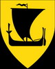
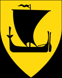
Coat-of-arms
The coat-of-arms is from modern times (1965). It shows the traditional boat of Nordland - the nordlandsbåt.
Twin region: Leningrad oblast, Russia
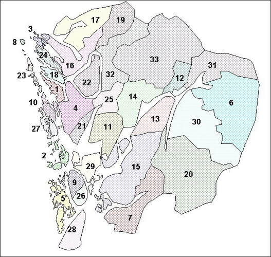
Municipalities
Location of Nordland MunicipalitiesMunicipalities of Hordaland
1. Askøy 18. Meland 2. Austevoll 19. Modalen 3. Austrheim 20. Odda 4. Bergen 21. Os 5. Bømlo 22. Osterøy 6. Eidfjord 23. Øygarden 7. Etne 24. Radøy 8. Fedje 25. Samnanger 9. Fitjar 26. Stord 10. Fjell 27. Sund 11. Fusa 28. Sveio 12. Granvin 29. Tysnes 13. Jondal 30. Ullensvang 14. Kvam 31. Ulvik 15. Kvinnherad 32. Vaksdal 16. Lindås 33. Voss 17. Masfjorden Districts
Location of Hordaland Districts:
Hardanger; Voss; Sunnhordland; Midhordland; Nordhordland.Hordaland is conventionally divided into traditional districts. The inland districts are Hardanger and Voss and the coastal districts are Sunnhordland, Midhordland, and Nordhordland. Strilelandet is the name of a more informal region commonly held to encompass Midhordland and Nordhordland. Stril is a name the inhabitants of Bergen apply to the people living in the traditionally agricultural areas surrounding the city.
Famous people from Hordaland
* Ole Bull, composer and violinist from Bergen
* Herman Friele, mayor and coffee king
* Edvard Grieg, composer from Bergen
* Gerhard Henrik Armauer Hansen, doctor from Bergen, the one to discover the leprosy bacteria, Mycobacterium leprae
* Ludvig Holberg, playwright and author from Bergen
* Roald 'Kniksen' Jensen, soccer player from Bergen
* Sissel Kyrkjebø, singer
* Leif Andreas Larsen, naval officer from Bergen
* Christian Michelsen, politician from Bergen, Norway's first Prime Minister
* Kari Traa, skier from Voss
* Varg Vikernes, black metal musician from Bergen
* Kurt Nilsen, singer, winner Norwegian Idol season one, and World Idol.Sister Regions
Hordaland county has the following official sister regions:Basse-Normandie, France; Cardiff, Wales, United Kingdom; Kaunas, Lithuania; Orkney Islands, Scotland, United Kingdom
Web Refernces: http://en.wikipedia.org/wiki/Hordaland
Lofoten, Norway Map
 Editor for Asisbiz: Matthew Laird Acred
If you love our website Please donate so we can make this site even better !!
Please donate so we can make this site even better !!