 |
 |
 |
 |
 |
 |
 |
 |
 |
 |
 |
 |
 |
 |
 |
 |
 |
 |
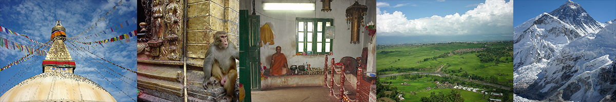
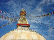
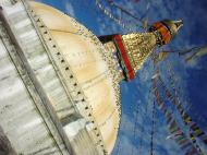
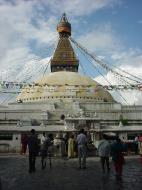
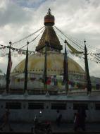
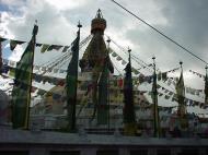
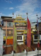
Boudhanath
Boudhanath (Devnagari: बौधनाथ) (also called Bouddhanath, Bodhnath or Baudhanath or the Khāsa Caitya) is one of the holiest Buddhist sites in Bouddha, Nepal. It is known as Khāsti by Newars as Bauddha or Bodh-nāth by modern speakers of Nepali. Located about 11 km (7 miles) from the center and northeastern outskirts of Kathmandu, the stupa's massive mandala makes it one of the largest spherical stupas in Nepal.
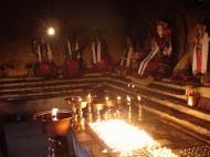
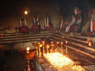
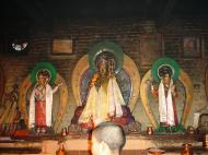
The Buddhist stupa of Boudhanath dominates the skyline. The ancient Stupa is one of the largest in the world. The influx of large populations of Tibetan refugees from China has seen the construction of over 50 Tibetan Gompas (Monasteries) around Boudhanath. As of 1979, Boudhanath is a UNESCO World Heritage Site. Along with Swayambhunath, it is one of the most popular tourist sites in the Kathmandu area.
The Stupa is on the ancient trade route from Tibet which enters the Kathmandu Valley by the village of Sankhu in the northeast corner, passes by Boudnath Stupa to the ancient and smaller stupa of Cā-bahī (often called 'Little Boudnath'). It then turns directly south, heading over the Bagmati river to Patan - thus bypassing the main city of Kathmandu (which was a later foundation). Tibetan merchants have rested and offered prayers here for many centuries. When refugees entered Nepal from Tibet in the 1950s, many decided to live around Bouddhanath. The Stupa is said to entomb the remains of a Kasyapa sage venerable both to Buddhists and Hindus.
Legend of the Construction of the Stupa
The village that surrounds the great Kāṣyapa tower is generally known by the name of Boddha. ...which in Tibetan is called Yambu Chorten Chenpo. Yambu is the general name by which Kāthmāndu is known in Tibet; and Chorten Chenpo means great tower. The real name of the tower in full is, however, Ja Rung Kashol Chorten Chenpo, which may be translated into: 'Have finished giving the order to proceed with.' The tower has an interesting history of its own which explains this strange name. It is said in this history that Kāṣyapa was a Buddha that lived a long time before Shākyamuni Buddha. after Kāṣyapa Buddha's demise, a certain old woman, with her four sons, interred this great sage's remains at the spot over which the great mound now stands, the latter having been built by the woman herself. Before starting on the work of construction, she petitioned the King of the time, and obtained permission to 'proceed with' building a tower. By the time that, as a result of great sacrifices on the part of the woman and her four sons, the groundwork of the structure had been finished, those who saw it were astonished at the greatness of the scale on which it was undertaken. Especially was this the case with the high officials of the country, who all said that if such a poor old dame were allowed to complete building such a stupendous tower, they themselves would have to dedicated a temple as great as a mountain, and so they decided to ask the King to disallow the further progress of the work. When the King was approached on the matter his Majesty replied: 'I have finished giving the order to the woman to proceed with the work. Kings must not eat their words, and I cannot undo my orders now.' So the tower was allowed to be finished, and hence its unique name, 'Ja Rung Kashol Chorten Chenpo.' I rather think, however, that the tower must have been built after the days of Shākyamuni Buddha, for the above description from Tibetan books is different from the records in Samskṛṭ, which are more reliable than the Tibetan.'History
The Gopālarājavaṃśāvalī says Bouhhanath was founded by the Nepalese Licchavi king Śivadeva (c. 590-604 CE); though other Nepalese chronicles date it to the reign of King Mānadeva (464-505 CE). Tibetan sources claim a mound on the site was excavated in the late 15th or early 16th century and the bones of king Aṃshuvarmā 605-621 were discovered there.However, the Tibetan emperor, Trisong Detsän (r. 755 to 797) is also traditionally associated with the construction of the Boudhanath Stupa.
Kathmandu
Kathmandu (Nepali: काठमांडौ, Nepal Bhasa: येँ) is the capital and the largest city of Nepal. The city is situated in Kathmandu Valley that also contains two other cities - Patan and Bhaktapur. Nepali is the lingua franca of the valley and is the most widely spoken language. Nepal Bhasa/Newari is the language spoken by native people, the Newars. English is understood by most of the educated population of the city. The city stands at an elevation of approximately 1400 m and is inhabited by about 700,000 people. Kathmandu has the most infrastructures among the cities in Nepal.
History
Kathmandu is situated in the heart of the Himalaya mountains, and has a rich history. Considered by some to be among the most beautiful cities in the world, the earliest known inscription in the Kathmandu Valley is dated 185 AD. The oldest firmly dated building in the earthquake-prone valley is almost 1,992 years old. Four stupas around the city of Patan said to have been erected by Charumati, attest to the ancient history present within the valley. The Kirats are the first documented rulers of Kathmandu Valley, the remains of their palace are in Patan near kendra Hiranyavarna Mahavihara (called 'Patukodon'). The Licchavi Dynasty whose earliest inscriptions date back to 464 AD were the next rulers of the valley. The Malla Dynasty consisted of Newar rulers, who ruled Kathmandu Valley and the surrounding area from the 12th century till the 17th century when the Shah Dynasty founder Prithvi Narayan Shah conquered the valley as he created present-day Nepal. Most of ancient Nepali Architecture present in Nepal today is from the Malla/Newar era.The city of Kathmandu is named after a structure in Durbar Square called Kaasthamandap. In Sanskrit, Kaasth (काष्ठ) is 'wood' and Mandap (मंडप/मण्डप) is 'covered shelter.' This unique temple, also known as Maru Sattal, was built in 1596 A.D. by King Laxmi Narsingh Malla. The entire structure contains no iron nails or supports and is made entirely from wood. Legend has it that the timber used for this two story pagoda was obtained from a single tree.
Kathmandu is also sometimes called 'Kantipur'. Kanti is an alternate name of the Goddess Laxmi, and Pur means the place where such a goddess resides; thus, the name Kantipur demonstrates the ancient belief that it is the place where Laxmi dwells. Newars, the native people of the Kathmandu valley use the original term from Nepal Bhasa, Yne.
Present
Kathmandu is home to most of the government offices, embassies, corporate houses, and palaces. The old palace of the Newar kings at Kathmandu Durbar Square is listed as UNESCO world heritage site. Nearby is Freak Street, which was the popular hippie spot during the 1970s. The former Shah King's Palace stands just east of Thamel - the tourist hub of the country. It consists of two parallel streets catering to tourists with shops, restaurants and little hotels. The palace is at the northern end of Durbar Marg, a major street lined with various shops and larger hotels.The 'old' city is noted for its many Buddhist and Hindu temples and palaces, most dating to the 17th century. Many of these landmarks have been damaged by earthquakes and pollution. Kathmandu has two important Buddhist stupas, Swayambhunath and Boudhanath and a famous Hindu shrine, Pashupatinath temple. Since 2003 the sites have been added to the World Heritage List as being 'in danger' out of concern for the ongoing loss of authenticity and the outstanding universal value of the cultural property.
Kathmandu has been popular with western tourists since the 1960's when it became a key stop on the Hippy Trail. It has also been the subject of a popular Bob Seger song for the same reason. It is rumoured that many rock singers used to visit Jho: Cheen and downtown Kathmandu in search of tranquility and Nirvana.
Tribhuvan International Airport is located at the eastern edge of the city, about 5 km from the city center, offering domestic and international flights.
Geography
The city is located in the northwestern part of Kathmandu Valley. The Kathmandu Valley covers an area of 565 sq. kilometres. It is situated at 1336 m above the sea level. Bagmati, Bishnumati, Dhobikhola, and Tukucha rivers wind through the city.Administrative divisions
The metropolitan has been divided into around 5 sectors by metropolitan authorities as follows:Central sector
The central sector consists of wards 1, 5, 11, 19, 31, 32 and 33.East sector
The east sector consists of wards 6, 7, 8, 9, 10 (Baneshwor), 34 and 35.North sector
The north sector consists of wards 2, 3, 4, 16, 29.City core
This is the most densely populated part of the city. This part consists of most of the historical and cultural monuments of the city.West sector
The west sector consists of wards 13, 14 and 15.Demographics
According to 2001 census, there are 235,387 households in the metropolitan city. Kathmandu metropolitan authorities estimate the number of people living in the city to be around 1,081,845 people The largest ethnic groups are Newars, Brahmins and Kshetris. The major languages are Nepali and Nepal Bhasa. The major religions are Hinduism and Buddhism.Government
The city is looked after by Kathmandu metropolitan office located at Bagdarbar. The city hosts Singhadarbar, the government seat of Nepal (with office of Prime Minister, Supreme Court and Senate). Most of the ministries are present in the Singha Darbar premises. The Naryanhiti Museum, previously a Royal Palace, is located in central part of city in ward number 1.Economy
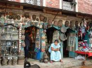
Tourism, sometimes said to be the 'third religion' of Nepal, is the country's most important industry, and plays a large role in the economic activity of Kathmandu. The neighborhood of Thamel is Kathmandu's primary 'traveler's ghetto,' packed with guest houses, restaurants, shops and bookstores catering to tourists from abroad. Freak Street, Kathmandu's original traveler's haunt made popular by the hippies of the 1970's, remains a popular alternative to Thamel.In addition, Kathmandu houses most of the banks, business houses, offices, organizations and share market of Nepal. The busiest economic centers are New Road of Kathmandu, Ason, Putalisadak and Darbar Marg. New Road is regarded as financial hub with presence of most of the banks in this street.
Notable landmarks
* Swayambhunath
* Pashupatinath Temple
* Boudhanath
* Tharlam Monastery
* Durbar SquareCultural impact
The city has been referenced in numerous songs, including works by Cat Stevens 'Katmandu', Mona Bone Jakon (1970)), Bob Seger ('Katmandu', Beautiful Loser (1975)), Krematorij ('Kathmandu', Three Springs (2000)), Fito Páez ('Tráfico por Katmandú' -- 'Traffic through Kathmandu'); Will Ackerman ('A Happy Home in Kathmandu', The Opening of Doors (1993)); Tantra ('The Hills of Katmandu', early 1980s); and Godiego ('Coming Together in Kathmandu' (1980).Numerous works of literature have been set in Kathmandu, including Kim Stanley Robinson's 1989 work, Escape from Kathmandu. Recently, the book ('Arresting God in Kathmandu') by Samrat Upadhyay has got international acclaim.
In some travelogues, the Kathmandu valley has been referred to as the 'Emerald Valley'.
The location is mentioned in the film Bewitched as the title of a fictional movie Will Ferrell's character stars in prior to his role in the Bewitched remake.
Nepal
Nepal Nepali: नेपाल is a landlocked nation in South Asia. It is bordered to the north by the People's Republic of China, and to the south, east, and west by India. Kathmandu, the nation's capital, is its largest city.
Nepal had been a monarchy throughout most of its history. Prithvi Narayan Shah, a nobleman, unified the many small kingdoms in the Himalayan valley in 1768. Since then, the country had been ruled by a dynasty of kings, until a civil war between monarchist forces and the Communist Party of Nepal led to the abdication of King Gyanendra and the establishment of a federal democratic republic in 2008.
Nepal is a country of highly diverse geography, culture, and religions. The mountainous north contains eight of the world's ten highest mountains, including the highest, Mount Everest. The fertile and humid south is heavily urbanized. Although Hinduism is practiced by a majority of the population, the nation also has a strong Buddhist tradition, as the birthplace of Siddharta Gautama.
Etymology
The word 'Nepal' is believed by scholars to be derived from the word 'Nepa:' which refers to the Newar Kingdom, the present day Kathmandu Valley. With Sanskritization, the Newar word Nepa became Nepal. The Newars of present day Nepal, refer to all the inhabitants of Kathmandu valley and its peripheries (called 'Nepa:') before the advent of Shah dynasty. The Nepal Sambat calendar, named after this Newar kingdom and devised 1100 years ago, is a national calendar used in Nepal and testifies to its antiquity.Ne Muni
Many historians and local traditions say that a Hindu sage named 'Ne' established himself at the valley of Kathmandu during prehistoric times and that the word 'Nepal' came into existence as the place protected ('pala' in Sanskrit) by the sage 'Ne'. The etymology of the name Nepal means, 'the country looked after by Ne'.He used to perform religious ceremonies at Teku, the confluence of the Bagmati and Bishnumati rivers. He is said by legend to have selected a pious cowherd to be the first of the many kings of the Gopala Dynasty. These rulers are said to have ruled Nepal for over 500 years. He selected Bhuktaman to be the first king in the line of the Gopal (Cowherd) Dynasty. The Gopal dynasty ruled for 621 years. Yakshya Gupta was the last king of this dynasty. However,this mythology can be challenged as no such name as Ne exists in Nepali or other Sanskrit derived languages.
According to Skanda Purana, a rishi called 'Ne' or 'Nemuni' used to live in Himalaya. In the Pashupati Purana, he is mentioned as a saint and a protector. He is said to have practiced penance at the Bagmati and Kesavati rivers and to have taught his doctrines there too.
Language
All the languages spoken in Nepal are national languages. Nepali is the official language of Nepal, with almost 60 percent of the population speaking it. This language, which is believed to be language with the closest derivation from Sanskrit, was originally called Khaskura, but became known as Nepali during the 20th century. Nepal's constitution, however, guarantees that, irrespective of what the official language is, all languages spoken in Nepal can be used for official purposes and documentation.In the capital Kathmandu, Nepal Bhasa (the Newar language) and Nepali are the most widely used languages.
History
Prehistory
Kathmandu Valley
Neolithic tools found in the Kathmandu Valley indicate that people have been living in the Himalayan region for at least 9,000 years. It appears that people who were probably of Kirant ethnicity lived in Nepal 2,500 years ago.Ancient
Terai News writes, 'Nepal has been highlighted for the last several centuries in Indian Sanskrit literature like ‘Skand Purana’. ‘Skanda Purana’ has a separate volume known as ‘Nepal Mahatmya’, which explains in more details about Nepal.' Nepal is also mentioned in Hindu scriptures such as the Narayana Puja and the Atharva Siras (800-600 BC). Around 1000 BC, small kingdoms and confederations of clans arose in the region. From one of these, the Shakya confederation, arose a prince named Siddharta Gautama (563–483 BC), who later renounced his royalty to lead an ascetic life and came to be known as the Buddha ('the enlightened one'). The 7th Kirata king, Jitedasti, was on the throne in the Nepal valley at the time. By 250 BC, the region came under the influence of the Mauryan empire of northern India, and later became a vassal state under the Gupta Dynasty in the fourth century AD. In the fifth century, rulers called the Licchavis governed the majority of its area. There is a good and quite detailed description of the kingdom of Nepal in the account of the renowned Chinese Buddhist pilgrim monk Xuanzang, dating from c. 645 AD.The Licchavi dynasty went into decline in the late eighth century and was followed by a Newari era, from 879, although the extent of their control over the entire country is uncertain. By the late 11th century, southern Nepal came under the influence of the Chalukaya Empire of southern India. Under the Chalukayas, Nepal's religious establishment changed as the kings patronised Hinduism instead of the prevailing Buddhism.
Medieval
By the early 12th century, leaders were emerging whose names ended with the Sanskrit suffix malla ('wrestler'). Initially their reign was marked by upheaval, but the kings consolidated their power and ruled over the next 200 years; by the late 14th century, much of the country began to come under a unified rule. This unity was short-lived; in 1482 the region was carved into three kingdoms: Kathmandu, Patan, and Bhaktapur.
Hindu temples in Patan, capital of one of the three medieval Newar kingdomsAfter centuries of petty rivalry between the three kingdoms, in the mid-18th century Prithvi Narayan Shah, a Gorkha King set out to unify the kingdoms. Seeking arms and aid from India, and buying the neutrality of bordering Indian kingdoms, he embarked on his mission in 1765. After several bloody battles and sieges, he managed to unify the Kathmandu Valley three years later in 1768. However, an actual battle never took place to conquer the Kathmandu valley; it was taken over by Prithvi Narayan and his troops without any effort, during Indra Jatra, a festival of Newars, when all the valley's citizens were celebrating the festival. This event marked the birth of the modern nation of Nepal.
Modern
There is historical evidence that, at one time, the boundary of Greater Nepal extended from the Tista River in the east to Kangara, across Sutlej River, in the west. A dispute and subsequent war with Tibet over the control of mountain passes forced the Nepalese to retreat and pay heavy reparations. Rivalry between Nepal and the British East India Company over the annexation of minor states bordering Nepal eventually led to the Anglo-Nepalese War (1815–16). The valor displayed by the Nepalese during the war astounded their enemies and earned them their image of fierce and ruthless 'Gurkhas'. The war ended in the Treaty of Sugauli, under which Nepal ceded recently-captured portions of Sikkim and lands in Terai to the Company.Factionalism inside the royal family had led to a period of instability. In 1846 a plot was discovered revealing that the reigning queen had planned to overthrow Jung Bahadur Rana, a fast-rising military leader. This led to the Kot Massacre; armed clashes between military personnel and administrators loyal to the queen led to the execution of several hundred princes and chieftains around the country. Jung Bahadur Rana emerged victorious and founded the Rana lineage. The king was made a titular figure, and the post of Prime Minister was made powerful and hereditary. The Ranas were staunchly pro-British and assisted them during the Indian Sepoy Rebellion in 1857 (and later in both World Wars). The decision to help British East India Company was taken by the Rana Regime, then led by Jang Bahadur Rana. Some parts of the Terai Region were given back to Nepal by the British as a friendly gesture, because of her military help to sustain British control in India during the Sepoy Rebellion. In 1923, the United Kingdom and Nepal formally signed an agreement of friendship, in which Nepal's independence was recognized by the UK.
Slavery was abolished in Nepal in 1924.
In the late 1940s, newly emerging pro-democracy movements and political parties in Nepal were critical of the Rana autocracy. Meanwhile, with the assertion of Chinese control in Tibet in the 1950s, India sought to counterbalance the perceived military threat from its northern neighbour by taking pre-emptive steps to assert more influence in Nepal. India sponsored both King Tribhuvan as Nepal's new ruler in 1951 and a new government, mostly comprising the Nepali Congress Party, thus terminating Rana hegemony in the kingdom. After years of power wrangling between the king and the government, the monarch scrapped the democratic experiment in 1959, and a 'partyless' panchayat system was made to govern Nepal until 1989, when the 'Jan Andolan' (People's Movement) forced the monarchy to accept constitutional reforms and to establish a multiparty parliament that took seat in May 1991.In 1996, the Communist Party of Nepal (Maoist) started a bid to replace the royal parliamentary system with a people's socialist republic. This led to the long Nepal Civil War and more than 12,000 deaths. On June 1, 2001, there was a massacre in the royal palace; it left the King, the Queen and the Heir Apparent Crown Prince Dipendra among the dead. Prince Dipendra was accused of patricide and of committing suicide thereafter, alleged to be a violent response to his parents' refusal to accept his choice of wife. However, there is speculation and doubts among Nepalese citizens about the person(s) responsible for the Royal Massacre. Following the carnage, the throne was inherited by King Birendra's brother Gyanendra. On February 1, 2005, Gyanendra dismissed the entire government and assumed full executive powers to quash the violent Maoist movement. In September 2005, the Maoists declared a three-month unilateral ceasefire to negotiate their demands.
In response to the 2006 democracy movement, the king agreed to relinquish the sovereign power back to the people and reinstated the dissolved House of Representatives on April 24, 2006. Using its newly acquired sovereign authority, on May 18, 2006, the newly resumed House of Representatives unanimously passed a motion to curtail the power of the king and declared Nepal a secular state, abolishing its time-honoured official status as a Hindu Kingdom. On December 28, 2007, a bill was passed in parliament to amend Article 159 of the constitution - replacing 'Provisions regarding the King' by 'Provisions of the Head of the State' - declaring Nepal a federal republic, and thereby abolishing the monarchy. The bill came into force on May 28, 2008 as a constituent assembly meeting in the capital, Kathmandu, overwhelmingly voted to abolish royal rule.
Recent events
The Communist Party of Nepal (Maoist) won the largest number of seats in the Constituent Assembly election held on April 10, 2008 and have thus formed a coalition government which includes most of the parties in the CA. But the Nepali Congress notably is not in the government. Although acts of violence occurred during the pre-electoral period, election observers noted that the elections themselves were markedly peaceful and 'well-carried out.'The Maoists had insisted on the abolition of the monarchy, with Nepal remaining democratic, but becoming a federal state with an elected head. The newly elected Assembly met in Kathmandu on May 28, 2008, and, after a polling of 564 constituent Assembly members, 560 voted to end Nepal's 240 year old monarchy, with the monarchist Rastriya Prajatantra Party, which had four members in the assembly, registering a dissent note. At that point, it was declared that Nepal had become a secular and inclusive democratic republic, with the government announcing a three-day public holiday from May 28 to 30. The King was thereafter given 15 days to vacate the Narayanhiti Royal Palace, in order to re-open it as a public museum. He did not, however, grant Royal Assent to the acts of either the interim parliament or the Constituent Assembly, especially that which declared a republic. Some have argued that as the interim constitution is repugnant to the 1992 constitution, which had never been legally abolished, making the republic – from either a de jure or royalist, divine right perspective – invalid, keeping Gyanendra as king.
Geography
Geography of Nepal is uncommonly diverse. Nepal is of roughly trapezoidal shape, 800 kilometres (500 mi) long and 200 kilometres (125 mi) wide, with an area of 147,181 square kilometres (56,827 sq mi). See List of territories by size for the comparative size of Nepal.Nepal is commonly divided into three physiographic areas: the Mountain, Hill, Siwalik region and Terai Regions. These ecological belts run east-west and are vertically intersected by Nepal's major, north to south flowing river systems.
The southern lowland Plains bordering India are part of the northern rim of the Indo-Gangetic plains. They were formed and are fed by three major rivers: the Kosi, the Narayani, and the Karnali. This region has a hot, humid climate.
The Hill Region (Pahad) abuts the mountains and varies from 1,000 to 4,000 metres (3,300–13,125 ft) in altitude. Two low mountain ranges, the Mahabharat Lekh and Shiwalik Range (also called the Churia Range) dominate the region. The hilly belt includes the Kathmandu Valley, the country's most fertile and urbanised area. Unlike the valleys called Inner Tarai (Bhitri Tarai Uptyaka), elevations above 2,500 metres (8,200 ft) are sparsely populated.
Mount Everest
The Mountain Region, situated in the Great Himalayan Range, makes up the northern part of Nepal. It contains the regions of highest altitude in the world; the world's highest mountain, 8,850 metres (29,035 ft) height Mount Everest (Sagarmatha in Nepali) is located here on the border with Tibet. Seven other of the world's ten highest mountains are located in Nepal: Lhotse, Makalu, Cho Oyu, Kanchenjunga, Dhaulagiri, Annapurna and Manaslu.Nepal has five climatic zones, broadly corresponding to the altitudes. The tropical and subtropical zones lie below 1,200 metres (3,940 ft), the temperate zone 1,200 to 2,400 metres (3,900–7,875 ft), the cold zone 2,400 to 3,600 metres (7,875–11,800 ft), the subarctic zone 3,600 to 4,400 metres (11,800–14,400 ft), and the Arctic zone above 4,400 metres (14,400 ft).
Nepal experiences five seasons: summer, monsoon, autumn, winter and spring. The Himalaya blocks cold winds from Central Asia in the winter and forms the northern limit of the monsoon wind patterns. In a land once thickly forested, deforestation is a major problem in all regions, with resulting erosion and degradation of ecosystems.
Nepal is popular for mountaineering, containing some of the highest and most challenging mountains in the world, including Mount Everest. Technically, the south-east ridge on the Nepali side of the mountain is easier to climb; so, most climbers prefer to trek to Everest through Nepal.
Until the Sugauli Sandhi (treaty) was signed, the territory of Nepal also included Darjeeling, and Tista to the east, Nainital to the south-west and Kumaun, Garwal and Bashahar to the west. However, today these areas are a part of India. As a result, Nepal shares no boundary with Bangladesh now and the two countries are separated by a narrow strip of land about 21 kilometres (13 mi) wide, called the Siliguri Corridor or Chicken's Neck. A huge majority of Nepalese still live there (almost 2 million). Efforts are underway to make this area a free-trade zone. The border dispute between India and Nepal has often been a cause of tension between the two countries.
Subdivisions
Nepal is divided into 14 zones and 75 districts, grouped into 5 development regions. Each district is headed by a permanent chief district officer responsible for maintaining law and order and coordinating the work of field agencies of the various government ministries. The 14 zones are:* Bagmati
* Bheri
* Dhawalagiri
* Gandaki
* Janakpur
* Karnali
* Kosi
* Lumbini
* Mahakali
* Mechi
* Narayani
* Rapti
* Sagarmatha
* SetiNeotectonics of Nepal
The collision between the Indian subcontinent and the Eurasian continent, which started in Paleogene time and continues today, produced the Himalaya and the Tibetan Plateau, a spectacular modern example of the effects of plate tectonics. Nepal lies completely within this collision zone, occupying the central sector of the Himalayan arc, nearly one third of the 2400km-long Himalayas.The Indian plate continues to move north relative to Asia at the rate of ~50mm/yr. Given the great magnitudes of the blocks of the Earth's crust involved, this is remarkably fast, about twice the speed at which human fingernails grow. As the strong Indian continental crust subducts beneath the relatively weak Tibetan crust, it pushes up the Himalaya mountains. This collision zone has accommodated huge amounts of crustal shortening as the rock sequences slide one over another. Erosion of the Himalayas is a very important source of sediment, which flows via great rivers (Indus, Ganges, Brahmaputra) to the Indian Ocean.
Structural and Neotectonic pattern of Nepal
The main structures of Nepal consist of several north-dipping thrust faults; the more important ones are the main frontal thrust (MFT), the main boundary thrust (MBT) and the main central thrust (MCT) (F. Jouanne et al.,2004). These thrust faults lie to the south of the South Tibetan Detachment System(STDS) which is a system of low angle normal faults and is also an important aspect of Nepal Himalayan tectonics.
Geological Map of Nepal Showing Major Tectonic Thrusts.The thrust faults trend generally 120°N in western Nepal, curving to 90°N in the eastern part of the country (Upreti & Le Fort 1999). These thrust faults, with generally southerly transport directions (Brunel 1986; Pecher 1991; Mugnier et al.,1999), are inferred to branch off the major basal detachment of the Himalayan thrust belt called the main Himalayan thrust (MHT) that localizes the underthrusting of the Indian lithosphere beneath the Himalayas and Tibet (Zhao et al., 1993). All the cross-sections made through the Himalayan belt advocate a mid-crustal ramp, below a large-scale antiformal structure of the Lesser Himalayas and to be north of a synformal structure(Schelling & Arita 1991; Srivastava & Mitra 1994; Pandey et al. 1990; DeCelles et al. 1998; Mugnier et al. 2003). Geological, geophysical and structural data indicate that there are lateral variations in the geometry of the MHT (Zhao et al.,1993; Pandey et al.1995,1999), but direct knowledge of the geometry of the MHT is sparse and therefore the validity of the profiles is still in debate. The thrusts are generally younger from north to south (24-21 Ma for the MCT, less than 2 Ma for the MFT) (Hodges et al. 1996; Harrison et al. 1997). On the basis of these faults, the structure of Nepal is generally subdivided into five tectonic zones:
1. Gangetic Plain (Terai) (area on the south of MFT)
2. Sub-Himalayas (Siwaliks)(area between MFT and MBT)
3. Lesser Himalayas (area between MBT and MCT)
4. Higher Himalayas (area between MCT and STDS)
5. Tibetan-Tethys (area north of STDS)Present-day deformation of Nepal
The modern deformation of the Himalayas is characterized by big earthquakes. Almost half of the continuing convergence between India and Eurasia is absorbed by underthrusting of the Indian lithosphere, beneath the Himalayas and Tibet along the MHT, as proposed by seismic investigations (Zhao et al.1993). Three of the big Nepalese earthquakes (1905, 1934 and 1950, with magnitudes around 8) were caused by the mid-crustal ramp along MHT (Pandey & Molnar 1989). The territory of Nepal is characterized by very intense microseismic activity, most of which follows approximately the topographic front of the Higher Himalaya (Pandey et al.,1999). Most of the earthquakes cluster between the MCT and MBT (Fig: Seismicity in the Himalayas of Nepal). Earthquake focal mechanisms indicate that the intermediate magnitude earthquakes are shallow depth (10-20km) beneath the Lesser Himalayas, demonstrating the activation of thrust planes gently dipping to the north (Ni and Barazangi, 1984). Detailed analysis of the Uttarkashi earthquake (Cotton et al. 1996) in the west of Nepal indicates that this event was initiated to the south of the Higher Himalayas front at 12±3 km depth corresponding to the southward propagation of a rupture along this segment of the MHT. A detailed study of the microseismic clusters suggests segmentation of the Himalayan arc (Pandey et al. 1999) and two major discontinuities segment the microseismicity belt at 82.5°E and 86.5°E. The projection along cross sections of the microseismic event (Fig:Cross-section and Projection of Microseimic Activity) reveals a noticeable change in shape of the clusters between central Nepal (rounded clusters are located in the vicinity of the flat-ramp transition of the MHT) and western Nepal (clusters are elongated and nearly horizontal) (F. Jouanne et al.,2004). Similarly, vertical displacement rates, expressed with reference to the Gangetic plain, indicate current uplift of the high Himalayas at 6 mm/yr, but also suggest active displacement along frontal thrusts inducing localized uplift (B. Antoine et al., 2004). There is change in maximum elevation between central (8500m) and western (7500m) Nepal and also a big difference in incision between eastern-central Nepal (6000m) and western Nepal (4500m)(B. Antoine et al., 2004). This is reflected in gentler relief in western Nepal and confirms the segmentation of geology and deformation observed with microseismicity and GPS measurements (Fig:Cross-section and Projection of Microseimic Activity).Conclusion: To summarise, the neotectonic deformation of Nepal is characterised by three major thrust faults (MCT, MBT and MFT) which are inferred to be the splay thrust of MHT that marks the underthrusting of the Indian lithosphere beneath the Himalayas. Likewise, there is a sudden change in geometry of the MHT between central and western Nepal, which is also marked in the Himalayan relief. The MHT is the main structure responsible for recent uplift and continuing deformation in Nepal. This hypothesis is reinforced by the observation that Quaternary displacement along the Main Frontal Thrust, southern emergence of the MHT and the convergence rate estimated across the Himalayas by GPS are both estimated at 18-20 mm/yr, which suggests that nearly all the displacement between India and Tibet is today transferred along the MHT (B. Antoine et al., 2004).
Government and politics
Nepal has seen rapid political changes during the last two decades. Until 1990, Nepal was an absolute monarchy running under the executive control of the king. Faced with a people's movement against the absolute monarchy, King Birendra, in 1990, agreed to large-scale political reforms by creating a parliamentary monarchy with the king as the head of state and a prime minister as the head of the government.Nepal's legislature was bicameral, consisting of a House of Representatives called the Pratinidhi Sabha and a National Council called the Rastriya Sabha. The House of Representatives consisted of 205 members directly elected by the people. The National Council had 60 members: ten nominated by the king, 35 elected by the House of Representatives, and the remaining 15 elected by an electoral college made up of chairs of villages and towns. The legislature had a five-year term but was dissolvable by the king before its term could end. All Nepali citizens 18 years and older became eligible to vote.
The executive comprised the King and the Council of Ministers (the Cabinet). The leader of the coalition or party securing the maximum seats in an election was appointed as the Prime Minister. The Cabinet was appointed by the king on the recommendation of the Prime Minister. Governments in Nepal tended to be highly unstable, falling either through internal collapse or parliamentary dissolution by the monarch, on the recommendation of the prime minister, according to the constitution; no government has survived for more than two years since 1991.
The movement in April 2006, brought about a change in the nation's governance: an interim constitution was promulgated, with the King giving up power, and an interim House of Representatives was formed with Maoist members after the new government held peace talks with the Maoist rebels. The number of parliamentary seats was also increased to 330. In April 2007, the Communist Party of Nepal (Maoist) joined the interim government of Nepal.
On December 10, 2007, the interim parliament passed a bill that would make Nepal a federal republic, with the Prime Minister becoming head of state. The bill was passed by the Constituent Assembly on May 28, 2008.
On April 10, 2008, the first election in Nepal for the constitution assembly took place. The Maoist party led the poll results but failed to gain a simple majority in the parliament.
On May 28, 2008, lawmakers in Nepal legally abolished the monarchy and declared the country a republic, ending 239 years of royal rule in the Himalayan nation. The newly elected assembly, led by the former communist rebels, adopted the resolution at its first meeting by an overwhelming majority. King Gyanendra was given 15 days to leave the former Royal Palace in central Kathmandu by the Nepalese Constituent Assembly. He left the former Royal Palace on June 11.
On June 26, 2008, Prime Minister Girija Prasad Koirala tendered his resignation to the Nepalese Constituent Assembly, which is also functioning as the Nepalese Parliament; however, a new Prime Minister has yet to be elected by the Nepalese Constituent.
Assembly.
On July 19, 2008, the first round of voting for the election of the country's president and vice president took place in the Constituent Assembly. Parmanand Jha became the first vice president of Nepal. However, the two presidential frontrunners, Dr. Ram Baran Yadav of Nepali Congress and the Maoist-backed candidate Ram Raja Prasad Singh, both failed to gain the minimum 298 votes needed to be elected, with Yadav receiving 283 votes and Singh receiving 270. 578 out of 594 CA members registered in the voter list had cast their votes, of which 24 were invalid.On July 21, 2008, the second round of voting was held. Yadav received 308 of the 590 votes casted, securing his election as president.
On August 15, 2008, Maoist leader Prachanda (Pushpa Kamal Dahal) was elected Prime Minister of Nepal, the first since the country's transition from a monarchy to a republic. Prachanda's election makes Nepal one of only three countries that currently have democratically-elected Communist state leaders, the other two being Cyprus and Moldova.
Military and foreign affairs
Nepal's military consists of the Nepalese Army, which includes the Nepalese Army Air Service (the air force unit under it.) Nepalese Police Force is the civilian police and the Armed Police Force Nepal is the paramilitary force. Service is voluntary and the minimum age for enlistment is 18 years. Nepal spends $99.2 million (2004) on its military—1.5% of its GDP. Many of the equipment and arms are imported from India. Consequently, the USA provided M16s M4s and other Colt weapons to combat communist (Maoist) insurgents. As of now, the standard-issue battle rifle of the Nepalese army is the Colt M16.Nepal has close ties with both of its neighbours, India and China. In accordance with a long-standing treaty, Indian and Nepalese citizens may travel to each others' countries without a passport or visa. Nepalese citizens may work in India without legal restriction. Although Nepal and India typically have close ties, from time to time Nepal becomes caught up in the problematic Sino-Indian relationship. Recently, China has been asking Nepal to curb protests in Nepal against China's Policy on Tibet, and on April 17, 2008, police arrested over 500 Tibetan protestors citing a need to maintain positive relations with China.
Terai News writes, 'Being a Hindu Nation Nepal has a permanent relation, especially with the important religious places of the northern states of India. Religion has played a great role in the cultural relations between Nepal and India.'
Economy
Nepal's gross domestic product (GDP) for the year 2005 was estimated at just over US$39 billion (adjusted to Purchasing Power Parity), making it the 83rd-largest economy in the world. Agriculture accounts for about 40% of Nepal's GDP, services comprise 41% and industry 22%. Agriculture employs 76% of the workforce, services 18% and manufacturing/craft-based industry 6%. Agricultural produce — mostly grown in the Terai region bordering India — includes tea, rice, corn, wheat, sugarcane, root crops, milk, and water buffalo meat. Industry mainly involves the processing of agricultural produce, including jute, sugarcane, tobacco, and grain. Its workforce of about 10 million suffers from a severe shortage of skilled labour. The spectacular landscape and diverse, exotic cultures of Nepal represent considerable potential for tourism, but growth in this hospitality industry has been stifled by recent political events. The rate of unemployment and underemployment approaches half of the working-age population. Thus many Nepali citizens move to India in search of work; the Gulf countries and Malaysia being new sources of work. Nepal receives US$50 million a year through the Gurkha soldiers who serve in the Indian and British armies and are highly esteemed for their skill and bravery. The total remittance value is worth around US1 billion, including money sent from the Persian Gulf and Malaysia, who combined employ around 700,000 Nepali citizens. A long-standing economic agreement underpins a close relationship with India. The country receives foreign aid from India, Japan, the United Kingdom, the United States, the European Union, China, Switzerland, and Scandinavian countries. Poverty is acute; per-capita income is less than US$470. The distribution of wealth among the Nepalis is consistent with that in many developed and developing countries: the highest 10% of households control 39.1% of the national wealth and the lowest 10% control only 2.6%.The government's budget is about US$1.153 billion, with expenditures of $1.789 billion (FY05/06). The Nepalese rupee has been tied to the Indian Rupee at an exchange rate of 1.6 for many years. Since the loosening of exchange rate controls in the early 1990s, the black market for foreign exchange has all but disappeared. The inflation rate has dropped to 2.9% after a period of higher inflation during the 1990s.
Nepal's exports of mainly carpets, clothing, leather goods, jute goods and grain total $822 million. Import commodities of mainly gold, machinery and equipment, petroleum products and fertilizer total US$2 bn. India (53.7%), the US (17.4%), and Germany (7.1%) are its main export partners. Nepal's import partners include India (47.5%), the United Arab Emirates (11.2%), China (10.7%), Saudi Arabia (4.9%), and Singapore (4%).
Nepal remains isolated from the world's major land, air and sea transport routes although, within the country, aviation is in a better state, with 48 airports, ten of them with paved runways; flights are frequent and support a sizable traffic. The hilly and mountainous terrain in the northern two-thirds of the country has made the building of roads and other infrastructure difficult and expensive. There were just over 8,500 km of paved roads, and one 59-km railway line in the south in 2003. There is only one reliable road route from India to the Kathmandu Valley. The only practical seaport of entry for goods bound for Kathmandu is Calcutta in India. Internally, the poor state of development of the road system (22 of 75 administrative districts lack road links) makes volume distribution unrealistic. Besides having landlocked, rugged geography, few tangible natural resources and poor infrastructure, the long-running civil war is also a factor in stunting the economic growth.
There is less than one telephone per 19 people. Landline telephone services are not adequate nationwide but are concentrated in cities and district headquarters. Mobile telephony is in a reasonable state in most parts of the country with increased accessibility and affordability; there were around 175,000 Internet connections in 2005. After the imposition of the 'state of emergency', intermittent losses of service-signals were reported, but uninterrupted Internet connections have resumed after Nepal's second major people's revolution to overthrow the King's absolute power.
Demographics
Perched on the southern slopes of the Himalayan Mountains, Nepal is as ethnically diverse as its terrain of fertile plains, broad valleys, and the highest mountain peaks in the world. The Nepalese are descendants of three major migrations from India, Tibet, and North Burma and Yunnan via Assam.Among the earliest inhabitants were the Kirat of east mid-region, Newar of the Kathmandu Valley and aboriginal Tharu in the southern Terai region. The ancestors of the Brahman and Chetri caste groups came from India's present Kumaon, Garhwal and Kashmir regions, while other ethnic groups trace their origins to North Burma and Yunnan and Tibet, e.g. the Gurung and Magar in the west, Rai and Limbu in the east (from Yunnan and north Burma via Assam), and Sherpa and Bhutia in the north (from Tibet).
In the Terai, a part of the Ganges Basin with 20% of the land, much of the population is physically and culturally similar to the Indo-Aryans of northern India. Indo-Aryan and East Asian looking mixed people live in the hill region. The mountainous highlands are sparsely populated. Kathmandu Valley, in the middle hill region, constitutes a small fraction of the nation's area but is the most densely populated, with almost 5% of the population.
Nepal is a multilingual, multireligious and multiethnic society. These data are largely derived from Nepal's 2001 census results published in the Nepal Population Report 2002.
According to the World Refugee Survey 2008, published by the U.S. Committee for Refugees and Immigrants, Nepal hosted a population of refugees and asylum seekers in 2007 numbering approximately 130,000. Of this population, approximately 109,200 persons were from Bhutan and 20,500 from People's Republic of China. The government of Nepal restricted Bhutanese refugees to seven camps in the Jhapa and Morang districts, and refugees were not permitted to work in most professions.
Languages Spoken in Nepal.
Despite the migration of a significant section of the population to the southern plains or terai in recent years, the majority of the population still lives in the central highlands. The northern mountains are sparsely populated.Kathmandu, with a population of around 800,000 (metropolitan area: 1.5 million), is the largest city in the country.
Religion
The main religion of Nepal is Hinduism. Shiva is regarded as the guardian deity of the country. Nepal is home to the largest Shiva temple in the world, the famous Pashupatinath Temple, where Hindus from all over the world come for pilgrimage. According to mythology, Sita Devi of the epic Ramayana was born in the Mithila Kingdom of King Janaka Raja. Buddhism was relatively more common among the Newar. Buddha is said to be a descendant of Sage Angirasa in many Buddhist texts. Scholars like Dr. Eitel connects it to the Rishi Gautama. But, differences between Hindus and Buddhists have been in general very subtle and academic in nature due to the intermingling of Hindu and Buddhist beliefs. Both share common temples and worship common deities; many of Nepal's Buddhists could also be regarded as Hindus and vice versa. Gurkhas from Nepal are Hindu. Among other natives of Nepal, those most influenced by Hinduism were the Magar, Sunwar, Limbu and Rai. Hindu influence is less prominent among the Gurung, Bhutia, and Thakali groups, who employ Buddhist monks for their religious ceremonies. Most of the festivals in Nepal are Hindu. The Machendrajatra festival, dedicated to Hindu Shaiva Siddha, is celebrated even by Buddhists and it is the Buddhists' main festival. As it is believed that Ne Muni established Nepal, important priests in Nepal are called 'Tirthaguru Nemuni'.Culture
Nepalese culture is diverse, reflecting different ethnic origins of the people. The Newar community is particularly rich in cultural diversity; they celebrate many festivals, well known for their music and dance.A typical Nepalese meal is dal-bhat-tarkari. Dal is a spicy lentil soup, served over bhat (boiled rice), served with tarkari (curried vegetables) together with achar (pickles) or chutni (spicy condiment made from fresh ingredients).. The Newar community, however, has its own unique cuisine. It consists of non-vegetarian as well as vegetarian items served with alcoholic and non-alcoholic beverages. Mustard oil is the cooking medium and a host of spices, such as cumin, coriander, black peppers, sesame seeds, turmeric, garlic, ginger, methi (fenugreek), bay leaves, cloves, cinnamon, pepper, chillies, mustard seeds, etc., are used in the cooking. The cuisine served on festivals is generally the best.
The Newari Music orchestra consists mainly of percussion instruments, though wind instruments, such as flutes and other similar instruments, are also used. String instruments are very rare. There are songs pertaining to particular seasons and festivals. Paahan chare music is probably the fastest played music whereas the Dapa the slowest. There are certain musical instruments such as Dhimay and Bhusya which are played as instrumental only and are not accompanied with songs. The dhimay music is the loudest one. In the hills, people enjoy their own kind of music, playing saarangi (a string instrument), madal and flute. They also have many popular folk songs known as lok geet and lok dohari.
The Newar dances can be broadly classified into masked dances and non-masked dances. The most representative of Newari dances is Lakhey dance. Almost all the settlements of Newaris organise Lakhey dance at least once a year, mostly in the Goonlaa month. So, they are called Goonlaa Lakhey. However, the most famous Lakhey dance is the Majipa Lakhey dance; it is performed by the Ranjitkars of Kathmandu and the celeberation continues for the entire week that contains the full moon of Yenlaa month. The Lakhey are considered to be the saviors of children.
Folklore is an integral part of Nepalese society. Traditional stories are rooted in the reality of day-to-day life, tales of love, affection and battles as well as demons and ghosts and thus reflect local lifestyles, cultures and beliefs. Many Nepalese folktales are enacted through the medium of dance and music.
The Nepali year begins in mid-April and is divided into 12 months. Saturday is the official weekly holiday. Main annual holidays include the National Day, celebrated on the birthday of the king (December 28), Prithvi Jayanti (January 11), Martyr's Day (February 18), and a mix of Hindu and Buddhist festivals such as dashain in autumn, and tihar in late autumn. During tihar, the Newar community also celebrates its New Year as per their local calendar Nepal Sambat.
Most houses in rural lowland of Nepal are made up of a tight bamboo framework and walls of a mud and cow-dung mix. These dwellings remain cool in summer and retain warmth in winter. Houses in the hills are usually made of unbaked bricks with thatch or tile roofing. At high elevations construction changes to stone masonry and slate may be used on roofs.
Nepal's flag is the only national flag in the world that is non-quadrilateral in shape, and one of only two non-rectangular flags in use (the other being the flag of the US state of Ohio). According to its official description, the red in the flag stands for victory in war or courage, and is also color of the rhododendron, the national flower of Nepal. Red also stands for aggression. The flag's blue border signifies peace. The curved moon on the flag is a symbol of the peaceful and calm nature of Nepalese, while the sun represents the aggressiveness of Nepalese warriors.
Web References:
http://en.wikipedia.org/wiki/Nepal
http://en.wikipedia.org/wiki/Kathmandu
Boudhha बौद्ध Kathmandu 44600 Nepal Map
 Editor for Asisbiz: Matthew Laird Acred
If you love our website Please donate so we can make this site even better !!
Please donate so we can make this site even better !!