 |
 |
 |
 |
 |
 |
 |
 |
 |
 |
 |
 |
 |
 |
 |
 |
 |
 |
 |
 |
 |
 |
 |
 |
 |
 |
 |
 |
 |
 |
 |
 |
 |
 |
 |
 |
 |
 |
 |
 |
 |
 |
 |
 |
 |
 |
 |
 |
 |
 |
 |
 |
 |
 |
 |
 |
 |
 |
 |
 |
 |
 |
 |
 |
 |
 |
 |
 |
 |
 |
 |
 |
 |
 |
 |
 |
 |
 |
 |
 |
 |
 |
 |
 |
 |
 |
 |
 |
 |
 |
 |
 |
 |
 |
 |
 |
 |
 |
 |
 |
 |
 |
 |
 |
 |
 |
 |
 |
 |
 |
 |
 |
 |
 |
 |
 |
 |
 |
 |
 |
 |
 |
 |
 |
 |
 |
 |
 |
 |
 |
 |
 |
 |
 |
 |
 |
 |
 |
 |
 |
 |
 |
Hong Kong 香港
Hong Kong 中華人民共和國香港特別行政區
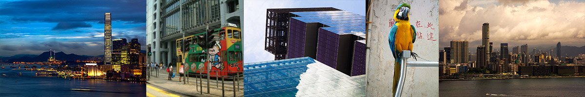
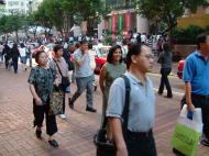
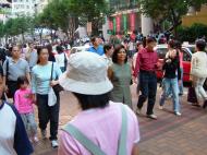
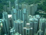
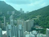
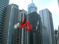
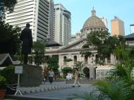
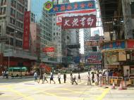
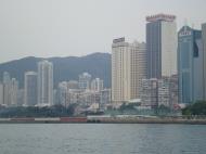
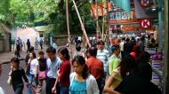
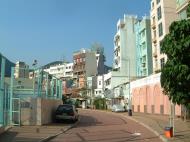
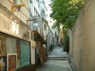
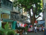
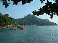
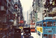
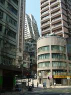
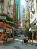
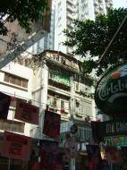
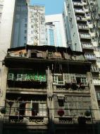
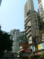
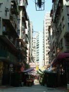
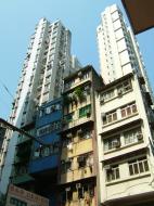
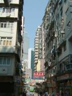
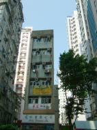
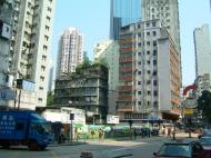
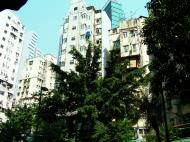
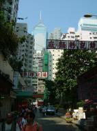
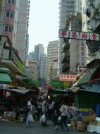
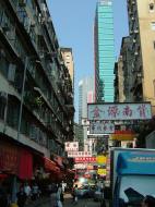
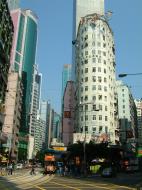
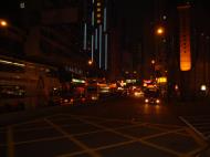
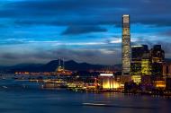
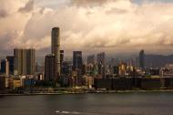
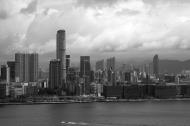
Hong Kong (Chinese: 香港), officially the Hong Kong Special Administrative Region, is a territory located in Southern China in East Asia, bordering the province of Guangdong to the north and facing the South China Sea to the east, west and south. It has a population of 7 million people but only 1,108km2 of land, making it one of the most densely populated areas in the world.
Beginning as a trading port, Hong Kong became a dependent territory of the United Kingdom in 1842, and remained so until transfer of sovereignty of Hong Kong to the People's Republic of China in 1997. Along with Macau, Hong Kong is one of the two special administrative regions under the One Country, Two Systems policy. As a result, Hong Kong is largely self-governing, it has its own currency, legal and political systems, a high degree of autonomy in all of its affairs, with the exception of foreign affairs and defence, and is generally not considered a part of mainland China.
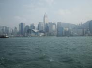
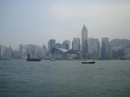
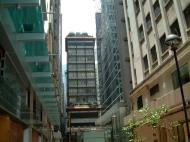
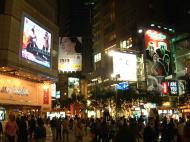
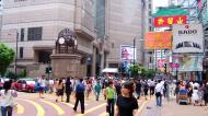
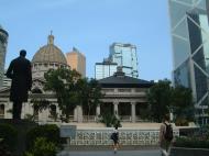
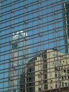
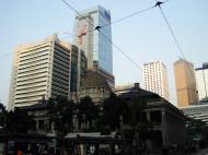
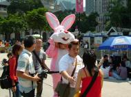
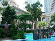
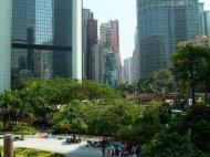
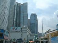
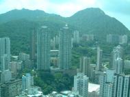
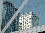
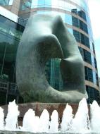
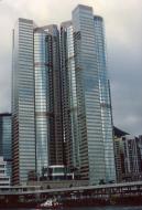
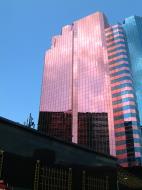
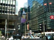
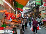
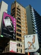
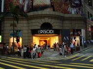
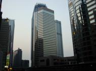
Renowned for its expansive skyline and natural setting, Hong Kong is one of the world's leading financial capitals, a major business and cultural hub, and maintains a highly developed capitalist economy. Its identity as a cosmopolitan centre where east meets west is reflected in its cuisine, cinema, music and traditions, and although the population is predominantly Chinese, residents and expatriates of other ethnicities form a small but significant segment of society.
The name 'Hong Kong' in the English language is an approximate phonetic rendering of the Cantonese or Hakka pronunciation of the Chinese name '香港', meaning 'fragrant harbour or port'. The original 'fragrant harbour' was a small inlet between the island of Ap Lei Chau and the south side of Hong Kong Island, now known as Aberdeen Harbour in English, but still called 'Heung Gong Tsai' (Little Hong Kong) in Cantonese.
It is not certain why Hong Kong harbour is so named. The reference to fragrance may refer to the harbour waters sweetened by the fresh water esturine influx of the Pearl River, or to the incense factories lining the coast to the north of Kowloon which was stored around Aberdeen Harbour for export, before the development of Victoria Harbour. The village of Heung Gong Tsuen on Ap Lei Chau is perhaps the earliest recorded use of the name.
Administrative districts
No. District Population Area New Territories 1. Islands 138,900 175.03 km2 (67.58 sq mi) 2. Kwai Tsing 510,300 21.82 km2 (8.42 sq mi) 3. North 287,700 137.31 km2 (53.02 sq mi) 4. Sai Kung 407,300 136.39 km2 (52.66 sq mi) 5. Sha Tin 606,700 69.46 km2 (26.82 sq mi) 6. Tai Po 292,700 147.42 km2 (56.92 sq mi) 7. Tsuen Wan 292,300 60.7 km2 (23.44 sq mi) 8. Tuen Mun 493,800 84.45 km2 (32.61 sq mi) 9. Yuen Long 533,300 138.43 km2 (53.45 sq mi) Kowloon 10. Kowloon City 359,400 9.97 km2 (3.85 sq mi) 11. Kwun Tong 579,400 11.05 km2 (4.27 sq mi) 12. Sham Shui Po 365,600 9.48 km2 (3.66 sq mi) 13. Wong Tai Sin 421,900 9.36 km2 (3.61 sq mi) 14. Yau Tsim Mong 285,300 6.85 km2 (2.64 sq mi) Hong Kong Island 15. Central and Western 253,100 12.52 km2 (4.83 sq mi) 16. Eastern 588,700 18.81 km2 (7.26 sq mi) 17. Southern 275,700 38.95 km2 (15.04 sq mi) 18. Wan Chai 155,700 10.02 km2 (3.87 sq mi) Districts of Hong Kong
Hong Kong is subdivided into 18 geographic districts for administrative purposes, each represented by a district council that advises the government on local matters such as public facilities, community programmes, cultural activities and environmental improvements. There are a total of 534 district councils seats, 405 of which are elected, while the rest are appointed by the Chief Executive and 27 ex officio chairmen of rural committees. The government's Home Affairs Department communicates government policies and plans to the public through the district offices.
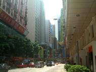
The 18 districts can be split into three areas, often used for statistical purposes. Hong Kong Island is the original 1842 colony, and contains Hong Kong's financial core on its northern coast. Kowloon is to the north across Victoria Harbour, the southern part of which was ceded in 1860. The much larger New Territories was the final addition to Hong Kong's territory in 1898.
As a special administrative region, Hong Kong is governed as a unitary authority, and as such there are no formal definitions for its cities and towns. One such example is Victoria City, which was one of the first urban settlements in Hong Kong after it became a colony, and was considered Hong Kong's capital city during British rule. Its historic boundary, along with that of Kowloon and New Kowloon, remain stated in law, but has not had any legal or administrative status since 1982.
Transport
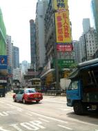
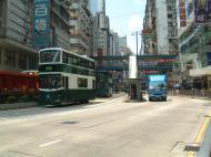
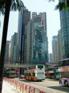
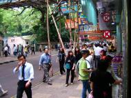
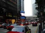
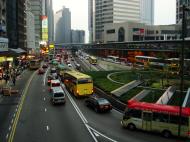
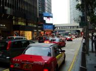
Hong Kong has a highly developed transportation network, encompassing both public and private transport. Over 90% of daily travels (11 million) are on public transport, making it the highest percentage in the world. The Octopus card, a stored value smart card payment system, can be used to pay for fares on almost all railways, buses and ferries, and also for parking and purchases at convenience stores and fastfood restaurants.
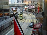
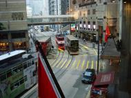
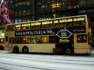
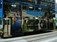
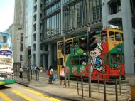
The city's rapid transit system, MTR, has 150 stations and serves 3.4 million people a day. A tramway system, serving the city since 1904, covers the northern parts of Hong Kong Island and is the only tram system in the world run exclusively with double deckers. Double-decker buses were introduced to Hong Kong in 1949, and are now almost exclusively used, with single-decker buses remaining in use for routes with lower demand or roads with lower carrying capacity. Most normal franchised bus routes in Hong Kong operate until 1 am. Public light buses run the length and breadth of Hong Kong, through areas where standard bus lines cannot reach or do not reach as frequently, quickly, or directly.
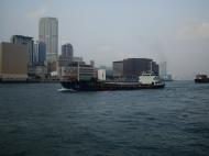
The Star Ferry service operates four lines across Victoria Harbour and has been in operation for over 120 years, providing a panoramic view of Hong Kong's skyline for its 53,000 daily passengers. It is considered one of the city's most treasured cultural icons and has been rated as one of the most picturesque ferry crossings in the world. Other ferry services are provided by operators serving outlying islands, new towns, Macau, and cities in mainland China. Hong Kong is also famous for its junks traversing the harbour, and small kai-to ferries which serve remote coastal settlements.
Hong Kong's steep, hilly terrain calls for some unusual ways of getting up and down the slopes. The Peak Tram, the first public transport system in Hong Kong, has provided vertical rail transport between Central and Victoria Peak since 1888 by steeply ascending the side of a mountain. In Central and Western district, there is an extensive system of escalators and moving pavements, including the longest outdoor covered escalator system in the world, the Mid-Levels escalator.
Hong Kong International Airport is a leading air passenger gateway and logistics hub in Asia and one of the world's busiest airports in terms of international passenger and cargo movement, serving more than 47 million passengers and handling 3.74 million tonnes of cargo in 2007. It replaced Kai Tak Airport in Kowloon in 1998, and has been rated as the world's best airport in a number of surveys. Over 85 airlines operate at the two-terminal airport and it is the primary hub of Cathay Pacific, Dragonair, Air Hong Kong, Hong Kong Airlines and Hong Kong Express.
List of streets and roads in Hong Kong
Routes
Hong Kong's Transport Department is responsible for maintenance and control of highways and roadways.
In 2004, a new strategic route marking system was put in place, with most existing routes renumbered and exits to key places or to another route also numbered. (For example, a journey from Yau Ma Tei to the airport uses Route 3, taking Exit 5 to join Route 8. It is therefore identified as "3-5-8".) Routes 1 to 3 are cross-harbour north-south routes following the order in which the harbour tunnels were opened. Routes 4, 5, 7 and 8 run east-west, numbered from south to north. Route 9 circumscribes the New Territories. Route 10 runs from western New Territories from Route 9 and bends northward towards and passes the border to Shenzhen.
The new system has caused some confusion to drivers used to relying on destination signs.
* Route 1: Aberdeen - Wong Chuk Hang - Aberdeen Tunnel - Causeway Bay - Cross-Harbour Tunnel - Kowloon Tong - Lion Rock Tunnel - Sha Tin (to join Route 9)
* Route 2: Quarry Bay - Eastern Cross-Harbour Tunnel - Kwun Tong Bypass - Tate's Cairn Tunnel - Ma Liu Shui (to join Route 9)
* Route 3: Sai Ying Pun - Western Cross-Harbour Tunnel - West Kowloon Highway - Kwai Chung - Tsing Yi - Cheung Tsing Tunnel - Ting Kau Bridge - Tai Lam Tunnel - Yuen Long (to join Route 9)
* Route 4: Chai Wan - Island Eastern Corridor - Quarry Bay - Causeway Bay - Wan Chai - Central - Sheung Wan - Sai Ying Pun - Kennedy Town
* Route 5: Ngau Tau Kok - Kowloon Bay - Airport Tunnel - Hung Hom - Yau Ma Tei - Lai Chi Kok - Kwai Chung - Tsuen Wan (to join Route 9)
* Route 6: Reserved for future route. Proposed Central Kowloon Route - Proposed Southeast Kowloon T2 Route - Proposed Tseung Kwan O - Lam Tin Tunnel
* Route 7: Tseung Kwan O - Tseung Kwan O Tunnel - Kwun Tong - Wong Tai Sin - Sham Shui Po - Lai Chi Kok - Kwai Chung (to join Route 5)
* Route 8: Chek Lap Kok (Airport) - Tsing Ma Bridge - Tsing Yi - Stonecutters Island - Lai Chi Kok - Sha Tin to join Route 9.
* Route 9: Shing Mun Tunnel - Tai Wai - Sha Tin - Ma Liu Shui - Tai Po - Fanling - Sheung Shui - San Tin - Yuen Long - - Tuen Mun - Sham Tseng - Tsuen Wan
* Route 10: Lam Tei - Shekou, ShenzhenExpressways
* Cheung Tsing Highway
* Fanling Highway
* Hong Kong-Shenzhen Western Corridor
* Island Eastern Corridor
* Kwun Tong Bypass
* Lantau Link
* North Lantau Highway
* Penny's Bay Highway
* San Tin Highway
* Sha Lek Highway
* Sha Tin Road
* Sha Tin Wai Road
* Tai Po Road - Sha Tin
* Tate's Cairn Highway
* Tolo Highway
* Tsing Kwai Highway
* Tsing Long Highway
* Tsuen Wan Road
* Tuen Mun Road
* West Kowloon Corridor
* West Kowloon Highway
* Yuen Long HighwayRoutes
* Route 1: Aberdeen - Wong Chuk Hang - Aberdeen Tunnel - Causeway Bay - Cross-Harbour Tunnel - Kowloon Tong - Lion Rock Tunnel - Sha Tin (to join Route 9)
* Route 2: Quarry Bay - Eastern Cross-Harbour Tunnel - Kwun Tong Bypass - Tate's Cairn Tunnel - Ma Liu Shui (to join Route 9)
* Route 3: Sai Ying Pun - Western Cross-Harbour Tunnel - West Kowloon Highway - Kwai Chung - Tsing Yi - Cheung Tsing Tunnel - Ting Kau Bridge - Tai Lam Tunnel - Yuen Long (to join Route 9)
* Route 4: Chai Wan - Island Eastern Corridor - Quarry Bay - Causeway Bay - Wan Chai - Central - Sheung Wan - Sai Ying Pun - Kennedy Town
* Route 5: Ngau Tau Kok - Kowloon Bay - Airport Tunnel - Hung Hom - Yau Ma Tei - Lai Chi Kok - Kwai Chung - Tsuen Wan (to join Route 9)
* Route 6: Reserved for future route. Proposed Central Kowloon Route - Proposed Southeast Kowloon T2 Route - Proposed Tseung Kwan O - Lam Tin Tunnel
* Route 7: Tseung Kwan O - Tseung Kwan O Tunnel - Kwun Tong - Wong Tai Sin - Sham Shui Po - Lai Chi Kok - Kwai Chung (to join Route 5)
* Route 8: Chek Lap Kok (Airport) - Tsing Ma Bridge - Tsing Yi - Stonecutters Island - Lai Chi Kok - Sha Tin to join Route 9.
* Route 9: Shing Mun Tunnel - Tai Wai - Sha Tin - Ma Liu Shui - Tai Po - Fanling - Sheung Shui - San Tin - Yuen Long - - Tuen Mun - Sham Tseng - Tsuen Wan
* Route 10: Lam Tei - Shekou, ShenzhenTunnels
Tunnels are a critical part of Hong Kong's transport infrastructure, given its mountainous and island topography. The first tunnel linked Kowloon with the new towns in the New Territories. Then the first cross-harbour tunnel to Hong Kong Island reduced reliance on ferries. Further construction facilitated traffic flow to the south of Hong Kong island and other parts of the New Territories. Later, as usage increased, additional tunnels became necessary in parallel with existing structures.
* Lion Rock Tunnel (1967)
* Cross Harbour Tunnel (1972)
* Second Lion Rock Tunnel (1978)
* Aberdeen Tunnel (1982, 1983)
* Kai Tak Tunnel (1982)
* Airport Tunnel (1982)
* Eastern Harbour Crossing (1990)
* Shing Mun Tunnel (1990)
* Tseung Kwan O Tunnel (1990)
* Tate's Cairn Tunnel (1991)
* Western Harbour Crossing (1997)
* Cheung Tsing Tunnel (1997)
* Tai Lam Tunnel (1998)
* Discovery Bay Tunnel (2000)
* Eagle's Nest Tunnel and Sha Tin Heights Tunnel (2008)Bridges
* Ap Lei Chau Bridge
* Cheung Tsing Bridge
Lantau Link
* Tsing Ma Bridge (shared with MTR Tung Chung Line/Airport Express)
* Ma Wan Viaduct (shared with MTR Tung Chung Line/Airport Express)
* Kap Shui Mun Bridge (shared with MTR Tung Chung Line/Airport Express)* Ting Kau Bridge
* Tsing Yi Bridge
* Tsing Tsuen Bridge (Tsing Yi North Bridge)
* Stonecutters Bridge (Under construction)Flyovers
* Canal Road Flyover
* Connaught Road West Flyover
* Tsing Fung Street FlyoverViaducts
* Kowloon Bay - Lam Tin Viaduct (MTR Kwun Tong Line)
* Lai King - Kwai Hing Viaduct (MTR Tsuen Wan Line)
* Heng Fa Chuen - Chai Wan Viaduct (MTR Island Line)
* Tsing Yi - Lai King Viaduct (MTR Tung Chung Line & MTR Airport Express)
* Kam Sheung Road - Tuen Mun Viaduct (West Rail Line)
* Sheung Shui - Lok Ma Chau Viaduct (East Rail Line)Hong Kong Island
* A Kung Ngam Road
* A Kung Ngam Village Road
* Aberdeen Main Road
* Aberdeen Praya Road
* Aberdeen Reservoir Road
* Aberdeen Street
* Albany Road
* Albert Path
* Aldrich Bay Road
* Aldrich Street
* Amoy Street
* Anton Street
* Ap Lei Chau Bridge Road
* Ap Lei Chau Drive
* Ap Lei Chau Praya Drive
* Arbuthnot Road
* Arsenal Street
* Babington Road
* Bank Street
* Barker Road
* Basel Road
* Battery Path
* Battery Street
* Beach Street
* Bel-air Avenue
* Bel-air Rise
* Belcher's Street
* Belleview Drive
* Big Wave Bay Road
* Bisney Road
* Black's Link
* Blue Pool Road
* Bluff Path
* Boat Street
* Bonham Road
* Bonham Strand
* Bonham Strand West
* Borrett Road
* Bowen Drive
* Bowen Road
* Boyce Road
* Braemar Hill Road
* Breeze Path
* Brewin Path
* Briar Avenue
* Bridges Street
* Broadwood Road
* Broom Road
* Brown Street
* Bullock Lane
* Burd Street
* Burrows Street
* Cadogan Street
* Caine Road
* Canal Road East
* Canal Road West
* Centre Street
* Chai Wan Road
* Chater Road
* Cheung Man Road
* Cleveland Street
* Cochrane Street
* Conduit Road
* Connaught Road Central
* Connaught Road West
* Connaught Place
* Davis Street
* Deep Water Bay Road
* Des Voeux Road Central
* Des Voeux Road West
* Duddell Street
* Elgin Street
* Eastern Street
* Fortress Hill Road
* Gage Street
* Garden Road
* Gilman Street
* Gilman's Bazaar
* Glenealy
* Gloucester Road
* Gordon Road
* Gough Hill Road
* Guildford Road
* Gutzlaff Street
* Harbour Parade
* Harbour Road
* Harcourt Road
* Hennessy Road
* Hill Road
* Hollywood Road
* Hong On Street
* Hong Shing Street
* Ice House Street
* Jardine's Bazaar
* Java Road
* Johnston Road
* Jubilee Street
* Ka Wai Man Road
* Ka Yip Street
* Kennedy Road
* Kennedy Town Praya
* King's Road
* Kornhill Road
* Ladder Street
* Lambeth Walk
* Lee Tung Street
* Lan Kwai Fong
* Lockhart Road
* Lok Man Road
* Lower Albert Road
* Luard Road
* Lugard Road
* Lung Wui Road
* Macdonnell Road
* Man Cheung Street
* Man Kwong Street
* Man Po Road
* Man Yiu Street
* Marsh Road
* May Road
* Mount Austin Road
* Mount Davis Road
* Mount Kellett Road
* Murray Road
* Nam Fung Road
* Northcote Close
* Oi Kwan Road
* Oi Lai Street
* Oi Yin Street
* Old Bailey Street
* Old Peak Road
* Park Road
* Paterson Street
* Peak Road
* Peel Street
* Pok Fu Lam Road
* Pollock's Path
* Pokfield Road
* Possession Street
* Pottinger Street
* Queen Victoria Street
* Queen's Road East
* Queen's Road Central
* Queen's Road West
* Queensway
* Robinson Road
* Sands Street
* Sandy Bay Road
* Sassoon Road
* Shau Kei Wan Road
* Shing Tai Road
* Shun Tai Road
* Siu Sai Wan Road
* Smithfield
* Staunton Street
* Staveley Street
* Stubbs Road
* Swatow Street
* Tai Hang Road
* Tai Koo Shing Road
* Tai Koo Wan Road
* Tai Man Road
* Tai Mou Avenue
* Tai Ping Shan Street
* Tai Tam Road
* Thomson Road
* Tim Wa Avenue
* Tim Mei Avenue
* Tin Wan Praya Road
* Tonnochy Road
* Tsat Tsz Mui Road
* Upper Albert Road
* Upper Lascar Row
* Victoria Road
* Wellington Street
* Western Street
* Westland Road
* Wharf Road
* Wing Kut Street
* Wing On Street
* Wing Sing Street
* Wing Tai Road
* Wong Nei Chung Road
* Wyndham Street
* Yee Wo StreetKowloon and New Kowloon
* Apliu Street
* Alnwick Road
* Argyle Street
* Ashley Road
* Austin Road
* Austin Road West
* Broadcast Drive
* Boundary Street
* Bulkeley Street
* Bute Street
* Castle Peak Road
* Canton Road
* Chatham Road North
* Chatham Road South
* Cherry Street
* Cheung Sha Wan Road
* Ching Cheung Road
* Choi Wan Road
* Choi Ha Road
* Clear Water Bay Road
* College Road
* Cox's Road
* Dorset Crescent
* Dundas Street
* Ede Road
* Essex Crescent
* Fa Yuen Street
* Fat Kwong Street
* Ferry Street
* Fuk Wa Street
* Gascoigne Road
* Haiphong Road
* Hankow Road
* Hillwood Road
* Humphreys Avenue
* Jordan Road
* Kai Cheung Road
* Kai Fuk Road
* Kimberley Street
* Knutsford Terrace
* Kowloon City Road
* Kwun Chung Street
* Lai Chi Kok Road
* Lancashire Road
* La Salle Road
* Maidstone Road
* Middle Road
* Mody Road
* Nathan Road
* New Clear Water Bay Road
* Nga Tsin Wai Road
* Observatory Road
* Pei Ho Street
* Peking Road
* Pilgrims Way
* Portland Street
* Prince Edward Road East
* Prince Edward Road West
* Princess Margaret Road
* Public Square Street
* Reclamation Street
* Sai Yeung Choi Street North
* Sai Yeung Choi Street South
* Salisbury Road
* Scout Path
* Shanghai Street
* Soy Street
* Tai Po Road
* Tai Wan Road
* Temple Street
* Tokwawan Road
* Tung Choi Street
* Wang Chiu Road
* Wang Kwong Road
* Waterloo Road
* Wylie Road
* York Road
* Yue Man SquareNew Territories
* A Kung Kok Road
* Castle Peak Road
* Che Kung Miu Road
* Ching Cheung Road
* Ching Hong Road
* Chung Mei Road
* Chung Ying Street
* Fan Kam Road
* Fo Tan Road
* Fung Shue Wo Road
* Hiram's Highway
* Hung Mui Kuk Road
* Joint Street
* Kam Sheung Road
* Kam Tin Road
* Kam Ying Road
* Kwai Chung Road
* Ma On Shan Road
* Mei Tin Road
* Lam Kam Road
* Lung Mun Road
* Po Lam Road
* Route Twisk
* Sai Sha Road
* Sam Shing Street
* San Sham Road
* Sha On Street
* Sha Tin Road
* Sha Tin Wai Road
* Sha Tin Tau Road
* Tai Po Road
* Tai Chung Kiu Road
* Tam Kon Shan Road
* Tin Sam Street
* Tsing Yi Heung Sze Wui Road
* Tsing Yi Road
* Tsing Yi Road West
* Tsing Yi Main Street
* Tsing Yi North Coastal Road
* Tsuen Wan Road
* Tuen Mun Road
* Wong Chu Road
* Wu King Road
* Wu Shan Road
* Yuen Wo RoadLantau
* Keung Shan Road
* Lantau Link
* Ngong Ping Road
* Sham Wat Road
* South Lantau Road
* Tai O Road
* Tung Chung RoadChek Lap Kok Airport
* Airport Road
* Airport Expo Boulevard
* Catering Road West
* Catering Road Central
* Catering Road East
* Chek Lap Kok South Road
* Cheong Hing Road
* Cheong Hong Road
* Cheong King Road
* Cheong Lin Path
* Cheong Lin Road
* Cheong Shun Road
* Cheong Tat Road
* Cheong Wing Road
* Cheong Wong Road
* Cheong Yip Road
* Chung Cheung Road
* East Coast Road
* Kwo Lo Wan Road
* North Perimeter Road
* Runway Road South
* Sky City Road
* Sky Plaza Drive
* Sky Plaza Road
* South Perimeter RoadCheung Chau
* Pak Sha Praya Road
* Pak Shue Street
* Peak Road
* Sun Hing Street
* Tung Wa Road
Hong Kong 香港 Map
 Editor for Asisbiz: Matthew Laird Acred
If you love our website Please donate so we can make this site even better !!
Please donate so we can make this site even better !!