|
 |
 |
 |
 |
 |
 |
 |
 |
 |
 |
 |
 |
 |
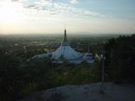
Maha Bodhi Ta Htaung Standing Buddha
ဗောဓိတစ်ထောင် ရပ်တော်မူဘုရားReclining Buddha
လျောင်းတော်မူဘုရား
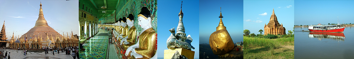
Bodhi Tahtaung Pagoda: Bodhi Tahtaung lies quite close to Thambuddhe Pagoda. In the precincts a thousand Bo Trees are planted with a shrine for each tree. It is a grand and splendid sight. Moreover there is also a massive Bodhi Ta Htaung Reclining Buddha Image.
Sagaing Division
Sagaing Division is an administrative division of Myanmar, located in the north-western part of the country between latitude 21° 30' north and longitude 94° 97' east. It is bordered by India’s Nagaland and Manipur States to the north, Kachin State, Shan State, and Mandalay Division to the east, Mandalay Division and Magway Division to the south, with the Ayeyarwady River forming a greater part of its eastern and also southern boundary, and Chin State and India to the west. The division has an area of 93,527 km², and population (1996) of over 5,300,000. The capital is Sagaing.
Sagaing Division consists of 198 wards and villages, 38 townships and eight districts; Sagaing, Shwebo, Monywa, Katha, Kale, Tamu, Mawlaik and Hkamti. The major cities are Sagaing, Monywa, Shwebo, Katha, Kale, Tamu, Mawlaik and Hkamti. Mingunwith its famous bell is located near Sagaing but can be reached across the Ayeyarwady from Mandalay.
History
The Pyu were the first to in recorded history to populate the area of Sagaing Division by the 1st century CE. The Bamar (Burmans) first migrated into Upper Myanmar by 7th century CE. The area came under the Pagan Kingdom certainly by the middle of 11th century when King Anawrahta (r. 1044-1077) founded the Pagan Empire, which encompasses the modern day Myanmar.After the fall of Pagan in 1287, the northwestern parts of Upper Myanmar came under the Sagaing Kingdom (1315-1364) ruled by Burmanized Shan kings. The area was ruled by the kings of Ava from 1364 to 1555 and the kings of Taungoo from 1555 to 1752. Konbaung Dynasty (1752-1885), founded by king Alaungpaya in Shwebo, became the last Burmese dynasty before the British conquest of Upper Burma in 1885. The area became Sagaing Division after the Burmese independence in January 1948.
Demographics
The Bamar (Burmans) are the majority ethnic group in the dry regions and along the Mandalay-Myitkyina Railroad. Shan live in the upper Chindwin River valley. A sizable minority of Naga resides in the north of north-west mountain ranges and Chin in the south. Smaller ethnic groups native to the Division include the Kadu and Ganang, who live in the upper Mu River valley and Meza River valley.
Economy
Agriculture is the chief occupation. The leading crop is rice, which occupies most of the arable ground. Other crops include wheat, sesame, peanut, pulses, cotton, and tobacco. Sagaing is Myanmar’s leading producer of wheat, contributing more than 80% of the country's total production. Forestry is important in the wetter upper regions along the Chindwin River, with teak and other hardwoods extracted. As in other parts of the country, reforestation is not effective enough to maintain sustainable forestry. Important minerals include gold, coal, salt and small amounts of petroleum. Industry includes textiles, copper refining, gold smelting, and a diesel engine plant. The Division has many rice mills, edible oil mills, saw mills, cotton mills, and mechanized weaving factories. Local industry includes earthen pots, silverware, bronze-wares, iron-wares and lacquerware.Web reference: https://en.wikipedia.org/wiki/Sagaing_Division
Amarapura, Myanmar (Burma) Map
 Editor for Asisbiz: Matthew Laird Acred
If you love our website Please donate so we can make this site even better !!
Please donate so we can make this site even better !!